The Enchanting Western Sichuan Loop: A Five-Day Soul Journey Through Snowy Peaks and Grasslands
Meta Description: Discover the ultimate Western Sichuan loop itinerary—5 days, 1,200 km of mountain roads. Explore Mount Siguniang, Haizi Valley, Jiajin Pass, and more. Your soul journey through snowy peaks and golden grasslands awaits.
Introduction: Why the Western Sichuan Loop Should Be Your Next Adventure
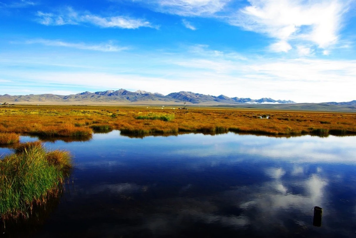
October transforms the Chengdu Plain into a gray, misty veil—but just beyond those layered mountain ranges, the Western Sichuan Plateau erupts in a grand autumn carnival. Skies clear as washed sapphire, sunlight blazing, snow-capped peaks towering, and golden grasslands stretching endlessly. This is the Western Sichuan Loop, a 1,200-kilometer odyssey that connects Garze and Aba prefectures, offering some of China's most breathtaking high-altitude landscapes.
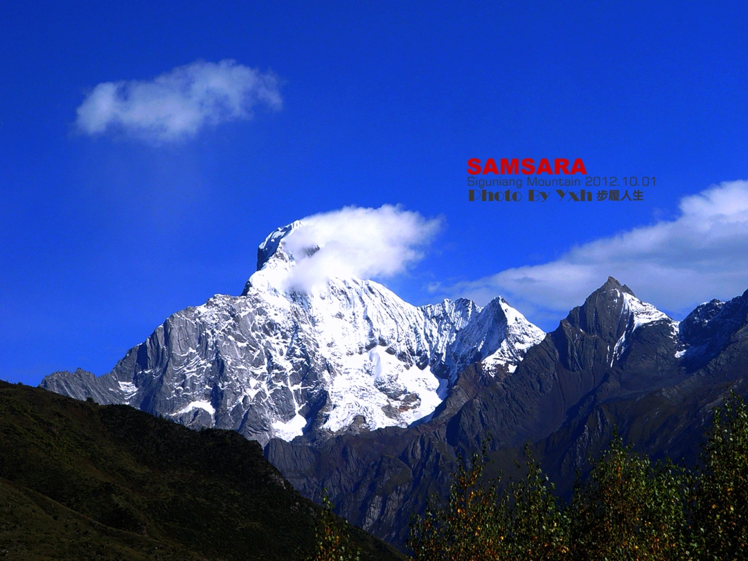
For travelers seeking an authentic self-drive experience, this route delivers everything: the "Eastern Alps" of Mount Siguniang, the majesty of Gongga Snow Mountain, the mystery of the Buddhist kingdom of Seda, and the pristine purity of Daocheng Yading. Unlike the crowded G318 or G317 highways, this classic loop remains relatively undiscovered—fewer cars, sparse crowds, and scenery that feels untouched.
The Route: Chengdu → Ya'an → Baoxing → Mount Siguniang → Xiaojin → Danba → Donggu → Xinduqiao → Kangding → Chengdu
Chapter One: Breaking Through the Fog – Crossing Mount Jiajin
Smart Travel Strategy: Beat the Holiday Crowds

The key to a successful Western Sichuan self-drive tour is timing. On the evening of September 29th, while most travelers prepared for the National Day holiday, I departed from Wenjiang in Chengdu. Choosing to travel the night before the holiday is experience earned from years of road trips—avoiding the desperate traffic jams of Day One and buying precious time for mountain crossings.
On the Chengyanqiong Expressway, car lights streaked by like shooting stars. By midnight, I exited the West Kang Bridge toll station in Ya'an as the National Day free passage began. A small hotel in Ya'an cost just 120 yuan—the best-condition and cheapest accommodation of the entire trip. (Pro tip: holiday pricing skyrockets, with basic farmstays reaching 300–500 yuan per night.)
Mount Jiajin: Following the Red Army's Footsteps
After a bowl of steaming noodles, I reached Feixian Pass—the first gateway to Tibet. Here, two routes diverge: straight ahead along the G318 over Erlang Mountain, or right onto the provincial road through Lushan and Baoxing, crossing Mount Jiajin to Xiaojin County.
I chose the latter. Mount Jiajin carries weighty history—the Red Army crossed this snow mountain during the Long March. Driving along the Qingyi River Gorge, the tranquil river murmured through the canyon. Passing Lushan County, children surrounded my car, pleading for photos. (Half a year later, this area would be hit by a devastating magnitude 7 earthquake—those innocent smiles remain in my memory.)
After Lushan, I entered Lingguan Gorge. Narrow canyon walls rose like rugged cliffs, the road just above the Qingyi River. On a wide platform, I stopped to photograph the boundary between Baoxing and Lushan. Baoxing itself is a small town embraced by mountains—green hills, clear waters, pleasant climate. No wonder giant pandas chose this place; it's where the first giant panda was discovered.
Continuing 60 kilometers brought me to Qiaoqi Tibetan Township. At over 2,000 meters altitude, plateau scenery emerges. Qiaoqi Lake (formerly Five Immortals Lake) stretched before me, its shores lined with farmstays—expensive but worth it.
Jiajin Pass: Battling the Clouds at 4,100 Meters

Entering Mount Jiajin National Forest Park, the wind picked up dramatically. The Dengchigou and Fengtongzhai Nature Reserves lie at the mountain's foot. As altitude rose to 3,000 meters, the road plunged into a cloud layer. Visibility dropped to under 10 meters—I crawled at 20 km/h, every bend nerve-wracking. Cyclists pedaled hard on this "heavenly ladder," earning my sincere admiration.
At the 4,100-meter pass, I still hadn't broken through the clouds. Disheartened—after years chasing seas of clouds in Western Sichuan, I'd only seen an imperfect one at Balang Mountain. But the aroma of grilled lamb skewers rescued my mood. Following the scent to an observation platform, I couldn't see distant scenery clearly, but that unique high-altitude smoke and fire was healing enough.
Chapter Two: The Gift of Mount Siguniang – Choosing Haizi Valley
Dawei: Sweet Encounter in Apple Country

After crossing Mount Jiajin, I reached Dawei Township in Xiaojin County about an hour later. This is where the Red Army joined forces—on June 12, 1935, the Fourth Front Army and Central Red Army met on Dawei Bridge. Today, it's an important red tourism site.
Xiaojin is famous as the land of apples. Plateau sunshine gives these apples unique quality—sweet, crisp, juicy, with rich aroma. Even more surprising: picking them yourself in the orchard costs just one to two yuan per pound. I bought a large bag, munching as I drove. That refreshing sweetness is unforgettable.
Mount Siguniang: Three Valleys, One Choice
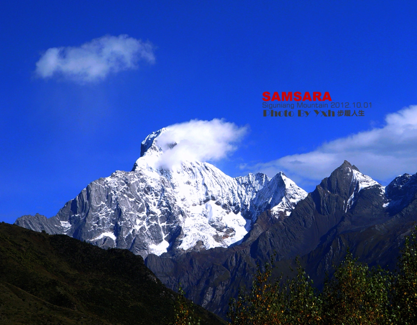
Driving 20 kilometers from Dawei, I arrived at Rilong Town at the foot of Mount Siguniang. Compared to six years ago, it had become much more prosperous. Domestic and international tourists flock here, all eager to behold the "Eastern Alps."
Mount Siguniang has three valleys: Shuangqiao Valley, Changping Valley, and Haizi Valley. Peak season tickets cost 80 yuan, 70 yuan, and 60 yuan respectively. Each valley has its character:
Shuangqiao Valley is the longest, with wide views and developed facilities. Sightseeing buses run the entire route, allowing visitors to see over a dozen famous peaks. But its obvious drawback: nowhere in the valley can you see the youngest sister peak of Mount Siguniang.
Changping Valley is more primitive, with ancient trees towering and winding boardwalks. You can get a close-up view of the youngest sister peak and even traverse to Bipeng Valley. However, most tour groups choose this valley—in golden autumn, it's packed with tourists.
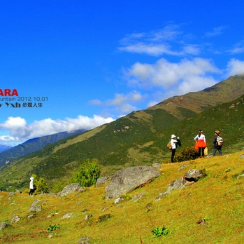
Haizi Valley is my recommendation. Less crowded, more serene, with alpine lakes (haizi) scattered across the landscape. The views of the four sisters peaks are spectacular, and the hiking trails are less demanding. At 60 yuan, it's the best value.
[Link: Best time to visit Mount Siguniang]
Chapter Three: Danba's Ancient Villages and Xinduqiao's Photographer's Paradise
Danba: The Kingdom of Ancient Stone Towers
From Xiaojin, the road winds toward Danba County, home to some of the most well-preserved ancient stone towers in Western Sichuan. These structures date back hundreds of years, built by the local Jiarong Tibetan people. The most famous site is Jiaju Tibetan Village, often called "the most beautiful ancient village in China."
The village perches on a hillside, white houses with red windows dotting the green slopes. In autumn, golden corn cobs hang from eaves, creating a photographer's dream. Entrance costs 50 yuan, and local families offer homestays for 150–200 yuan per night.
[Link: Top 10 Tibetan villages in Western Sichuan]
Donggu and the Road to Xinduqiao
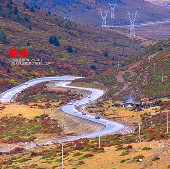
Leaving Danba, the road climbs through Donggu Valley. This section offers some of the loop's most dramatic scenery—steep cliffs, rushing rivers, and distant snow peaks. The road is narrow but well-maintained, with frequent viewpoints for photo stops.
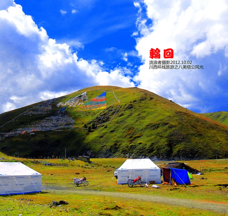
Xinduqiao, known as "Photographer's Paradise," lies at the intersection of several routes. This small town at 3,300 meters offers stunning views of the Yala Snow Mountain and Gongga Mountain. Sunset here is legendary: golden light paints the grasslands, yaks graze peacefully, and prayer flags flutter in the wind.
[Link: Xinduqiao photography tips]
Chapter Four: Kangding and the Return to Chengdu
Kangding: The Gateway to Tibet
From Xinduqiao, it's a short drive to Kangding, the cultural heart of Garze Prefecture. Known as the "Gateway to Tibet," Kangding sits at 2,560 meters and offers a blend of Tibetan and Han cultures. The famous love song "Kangding Love Song" originates here.
Must-visit spots include Paoma Mountain (cable car up for panoramic views) and the Kangding Monastery. The town's night market serves excellent yak meat hot pot and butter tea.
The Return: Erlang Mountain Tunnel
The final leg takes you over Erlang Mountain via the newly built tunnel system. This engineering marvel cuts travel time to Chengdu to just 3–4 hours. The old road over Erlang Mountain is now largely abandoned, but adventurous drivers can still find sections for stunning views.
Frequently Asked Questions
1. What is the best time to drive the Western Sichuan Loop?
October is peak season for autumn colors. May–June offers wildflowers and fewer crowds. July–August brings rain and potential landslides. Winter (November–March) offers snow views but requires careful driving.
2. Do I need a 4WD vehicle for this route?
 A regular sedan can handle most of the loop, but a 4WD or SUV is recommended for mountain passes like Jiajin and Balang. Check road conditions before departure.
3. How should I prepare for high altitude?
Acclimatize in Kangding (2,560m) before attempting higher passes. Bring altitude sickness medication, drink plenty of water, avoid alcohol, and ascend gradually. Most passes are 4,000–4,500 meters.
4. What permits do I need?
 No special permits are required for this route. However, if you plan to visit Seda or Daocheng Yading, you may need advance registration. Carry your passport and driving license.
5. How much does the trip cost?
Budget 1,500–2,500 yuan per person for 5 days including fuel, accommodation, food, and entrance fees. Holiday pricing doubles accommodation costs.
[Link: Western Sichuan budget travel guide]
Conclusion: Your Soul Journey Awaits
The Western Sichuan Loop isn't just a road trip—it's a pilgrimage through some of China's most sacred landscapes. From the misty passes of Jiajin to the golden grasslands of Xinduqiao, from the ancient towers of Danba to the snow peaks of Mount Siguniang, every kilometer offers a new revelation.
The most beautiful scenery is never at the destination, but on the road itself. So pack your bags, check your tires, and set out. The plateau's brilliant sun awaits.
Ready to plan your Western Sichuan adventure? [Book your car rental] | [Download our route map] | [Join our travel community]
Note: This article is based on a real journey. Road conditions and prices may change. Always check current information before traveling.
You may also like