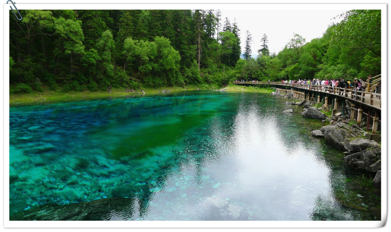
Two Days and Nights Under the Three Holy Mountains: An Extreme Dialogue Between Body and Will
Meta Description: Experience the ultimate high-altitude trekking challenge in Daocheng Yading. Discover how an unprepared office worker survived two days alone at 4,500m—a story of science, willpower, and raw beauty.
Introduction: From Desk Job to 14,700 Feet
Some decisions are born in a flash. In December 2015, while tapping away at my keyboard in Hangzhou, a thought crashed into my mind: go trekking in Daocheng Yading. Not a whim, but a long-brewing experiment. I had plans to trek in Nepal and around Everest's east face, yet I had never carried dozens of kilograms of gear at high altitude. I needed a testing ground—a place to see if I could survive the combined pressures of high elevation, freezing temperatures, and heavy loads.
The Three Holy Mountains scenic area in Daocheng Yading became the perfect choice. Over 4,000 meters above sea level, it fully met the requirements for a high-altitude test. More importantly, as a developed scenic area, the facilities and safety margins were manageable—even in the off-season. So I bought a ticket from Hangzhou to Daocheng and, in the bitter cold of early December, set off on this solitary pilgrimage.
This article is not just a travelogue. It's a survival guide, a psychological case study, and a testament to what an ordinary person can achieve with the right preparation and mindset. If you're considering high-altitude trekking in Daocheng, or simply want to understand the extreme dialogue between body and will, read on.
H2: Why Daocheng Yading? The Ultimate High-Altitude Testing Ground
H3: The Three Holy Mountains: A Natural Temple

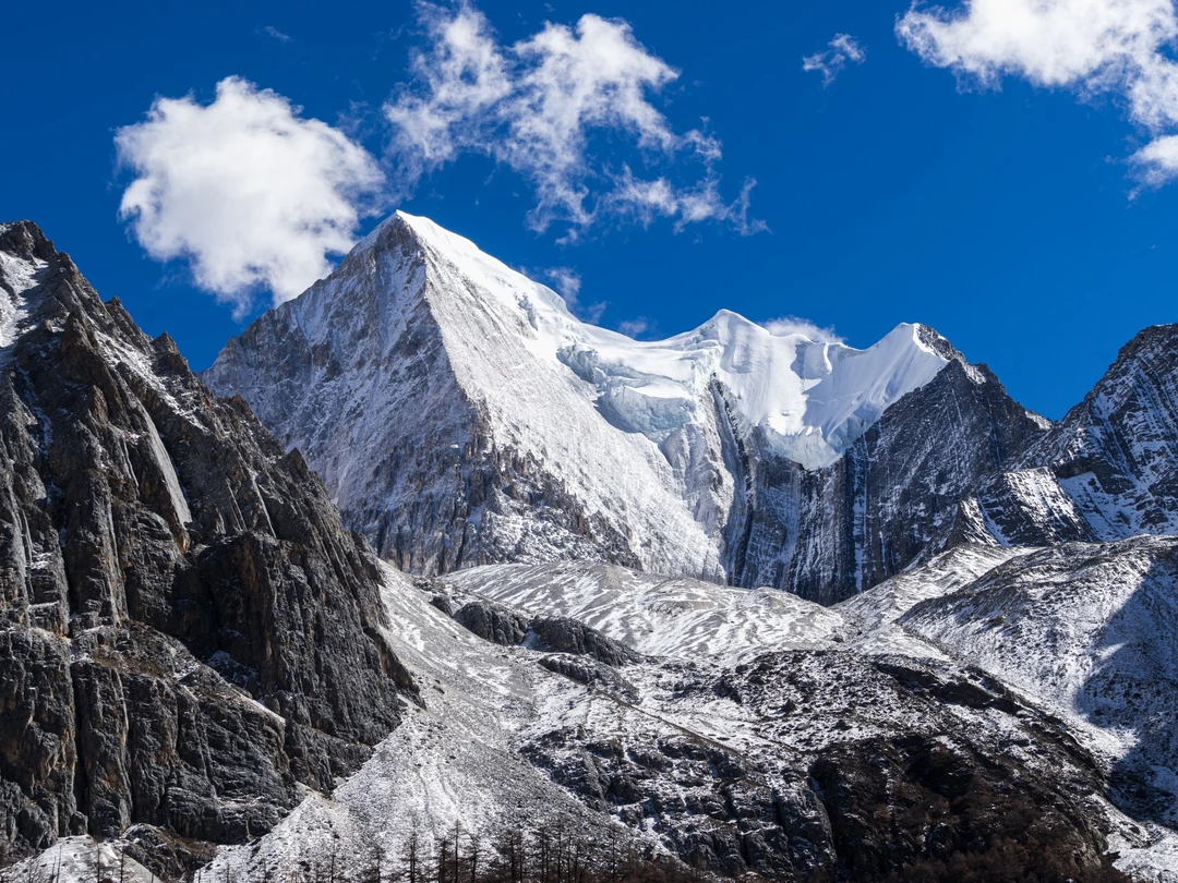
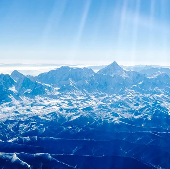
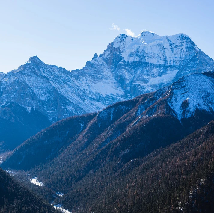
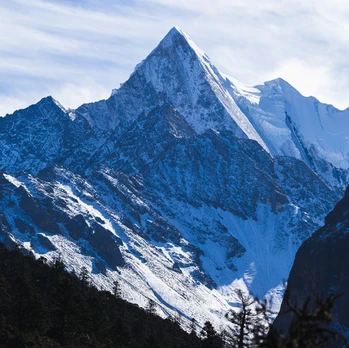
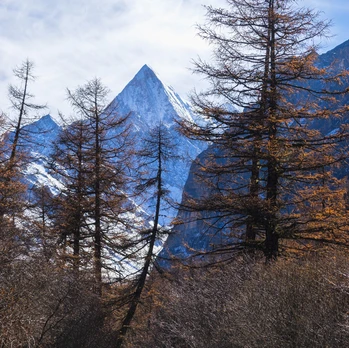
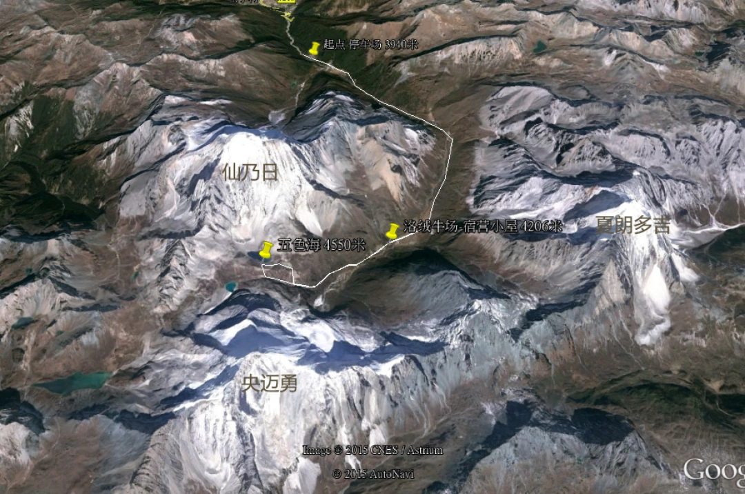
Daocheng Yading is home to three sacred peaks: 仙乃日 (Chenresig), 央迈勇 (Jambeyang), and 夏朗多吉 (Chana Dorje). Known collectively as the Three Guardian Mountains, they form a natural temple that draws pilgrims and trekkers from around the world. At over 4,000 meters, this is a place where the air thins and the body screams for oxygen.
H3: Winter's Wilderness: Beauty and Brutality Entwined
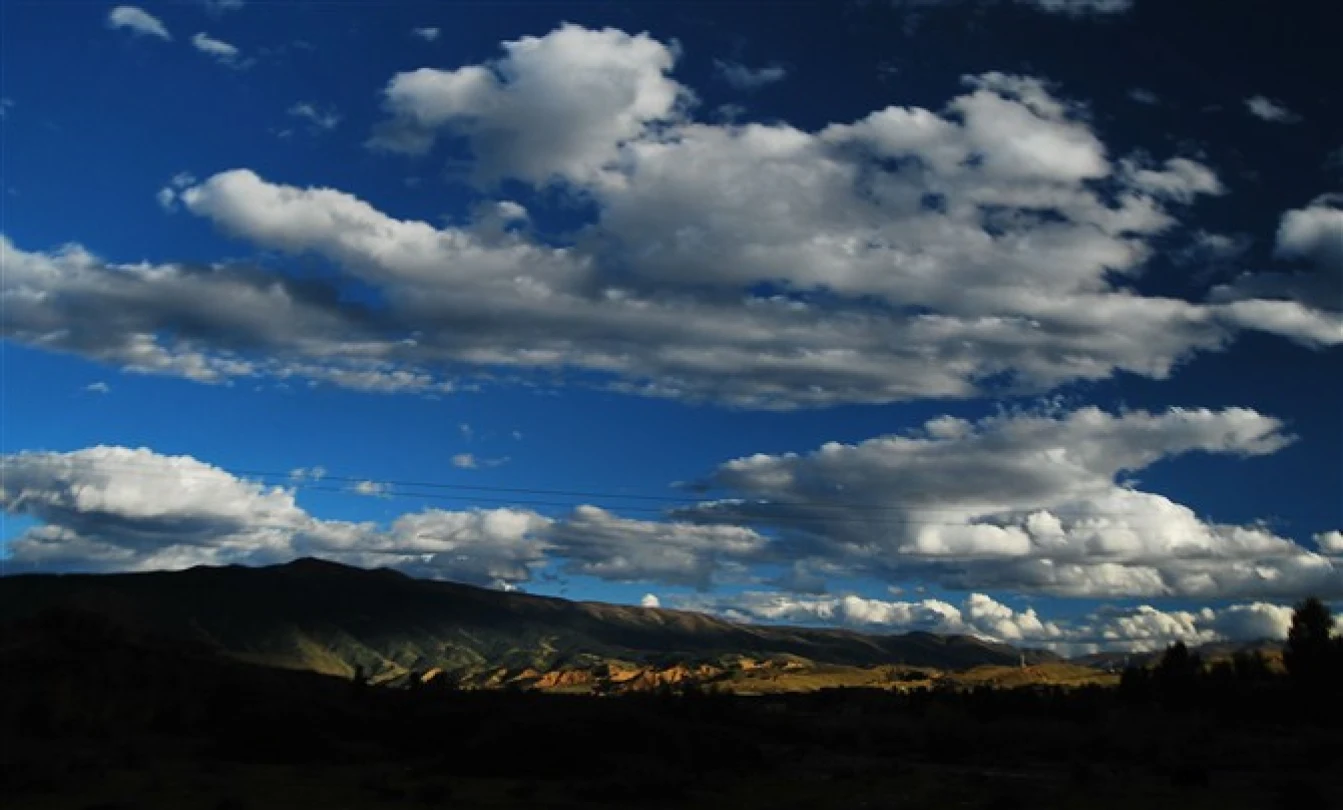
December through January is the dry season in western Sichuan. The air is parched, clouds are scarce, and you're most likely to see the mountains in their full glory. Tourists are few, and the entire landscape feels like it belongs to you alone. But winter exacts a heavy toll: temperatures plummet, roads turn to ice, and transportation, food, and lodging within the scenic area are drastically reduced. The golden leaves and turquoise lakes of autumn have vanished, replaced by a world of gray and white silence.
I—a desk-bound "office animal" who almost never exercised—was about to be airlifted from sea-level Hangzhou to a snowy mountain region over 4,000 meters high, carrying a heavy pack for two days of trekking. Honestly, I had no idea if I could pull it off.
H2: The Science of Survival: Lightweight, Warmth, Energy, Rest
H3: Four Keywords That Saved My Life
My only strategy was to rely on scientific gear and smart decision-making to compensate for my lack of fitness. I boiled the core principles of this trek down to four keywords: lightweight, warmth, energy replenishment, and rest. These four words guided every decision I made—from choosing equipment to planning the route, from pacing myself to deciding when to set up camp.
- Lightweight: Every gram counted. I chose a liquid fuel stove over a gas canister (though in hindsight, gas would have been easier).
- Warmth: Layering was critical. Merino wool base layers, down jacket, and a waterproof shell.
- Energy Replenishment: High-calorie snacks, electrolyte tablets, and plenty of water.
- Rest: Scheduled breaks every 30 minutes to prevent altitude sickness.
It was this knowledge that allowed me, an ordinary person with no physical preparation, to complete what seemed like an impossible mission. Though the journey was filled with pain and fear, it gave me a profound realization: the battle between mind and body never ceases. The body is like a stubborn donkey, always wanting to quit and retreat; the mind is the whip-wielding driver, constantly pushing it forward, while also using science to feed it and care for it, so it doesn't collapse completely before you reach your destination.
H2: Route Planning: Compromise Between Ambition and Reality
H3: Google Earth Simulations vs. Real-World Limits
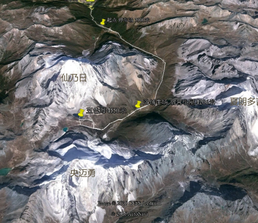
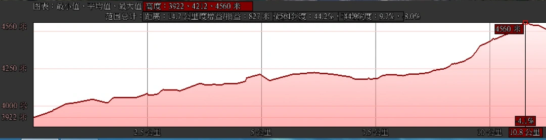
Using Google Earth, I mapped out my trekking route in advance. One way was about 15 kilometers, with a cumulative elevation gain of over 800 meters. Adding the later trip to 卓玛拉错 (Pearl Lake), the total distance was expected to be around 35 kilometers, with a total ascent of about 1,000 meters.
My original plan was to complete a full circuit of Mount 仙乃日. But winter reality quickly sobered me up: given my fitness level, this was nearly impossible. Moreover, Google Earth simulations showed that the final third of the 仙乃日 circumambulation route offered mediocre views, with no grand snowy peaks in sight. After weighing the options, I abandoned that plan and focused on exploring the core area.
H3: The Campsite at the Heart of the Temple

In the days before departure, I kept imagining: what would it be like to spend the night among the distant, icy Three Guardian Mountains? What kind of silent, mysterious, and wonderful experience would that be? My planned campsite lay at the very heart of this natural temple. Just the thought of spending the night there filled me with indescribable happiness.
But I shared this vision with no one. Everyone around me was absorbed in their own lives. Though we occupied the same physical space, people actually live in completely different worlds.
H2: Day One: From Airport to Wilderness
H3: The World's Highest Civilian Airport
On the early morning of December 7th, I took off from Hangzhou, with a stopover in Chongqing. I was the only passenger continuing on to Daocheng. Half an hour later, the plane, carrying just over a dozen new passengers, continued westward.
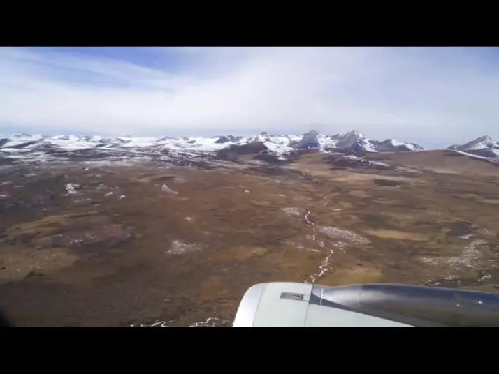
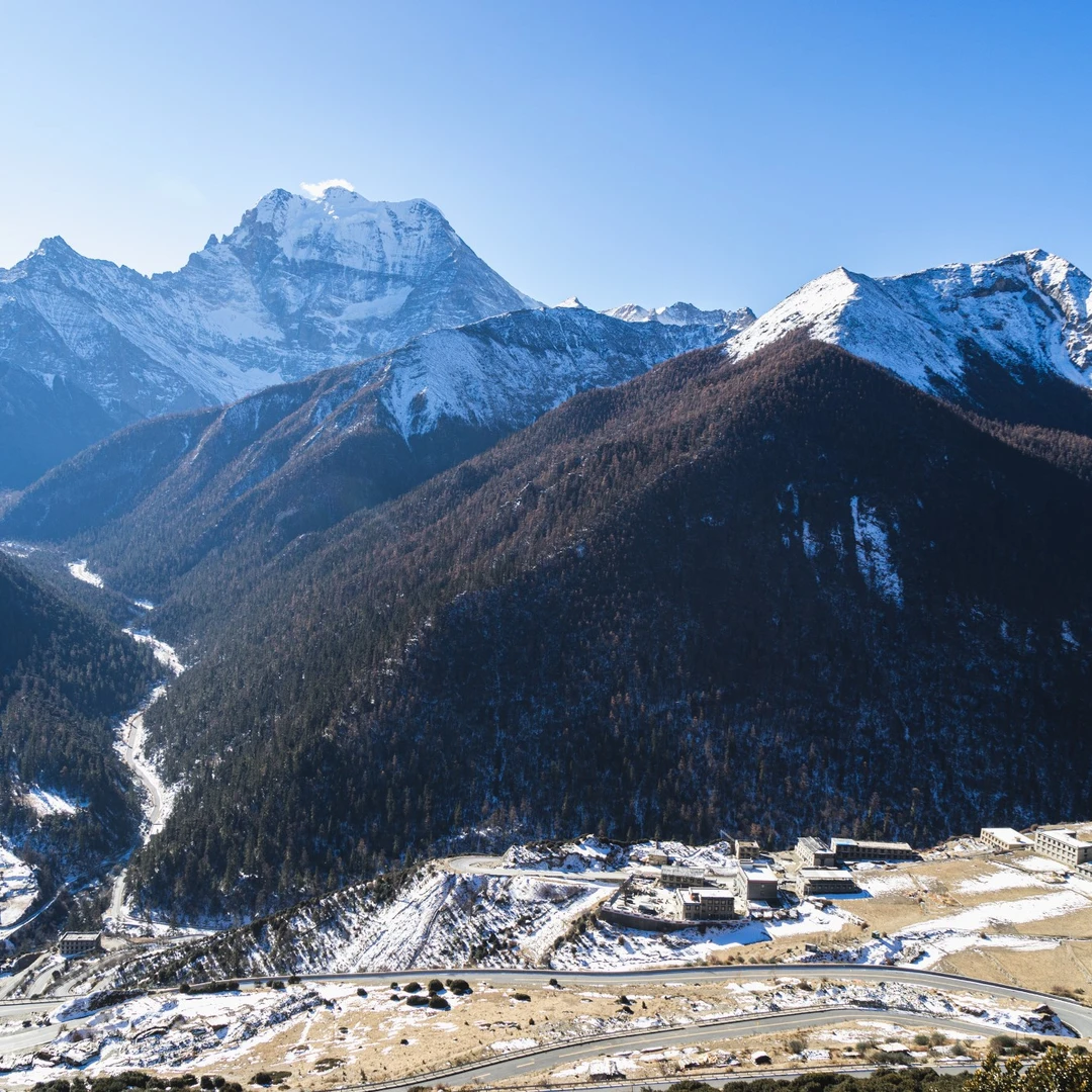
The plane landed at the world's highest civilian airport—Daocheng Airport, at 4,500 meters above sea level. The air on the Tibetan Plateau was so pure it was almost suffocating. The colors of the landscape were vivid, the lines sharp—a stark contrast to the gray haze of Hangzhou and Chongqing. This pristine clarity was the first visual baptism for any newcomer.
In 2014, I had driven here from Hangzhou, a journey that took nearly 10 days. Back then, this place felt like "the very, very far end of the earth." This time, the same distance took less than four hours. The convenience, however, came at the cost of the ritualistic sense of pilgrimage that comes with a long journey.
H3: The Norwegian Backpacker: A Missed Opportunity
From the airport, I took a bus to Daocheng County town, then shared a ride with two other tourists to 香格里拉镇 (Shangri-La Town). Along the way, we picked up a Norwegian backpacker—a high school graduate who had already traveled across Southeast Asia, Mongolia, and Nepal. He also wanted to circumambulate 仙乃日, but he couldn't find any place to buy camping gear. Too bad—if I'd had a companion, the later journey might have been less lonely and terrifying.
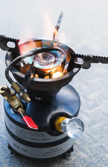
We arrived in 香格里拉镇 at 4 PM. The scenic area shuttle bus had already stopped running, so I had to find lodging. I had bought a liquid fuel stove in Hangzhou in advance—because I'd heard you couldn't buy gas canisters in Daocheng. But liquid fuel stoves have many drawbacks: they're heavy, have low thermal efficiency, require constant pumping, clog easily, and produce a lot of soot on the outside of pots, soiling your gear. Unless absolutely necessary, stick with a gas stove.
[Link: Best camping stoves for high-altitude trekking]
H2: Day Two: The Journey Begins
H3: Empty Stomach, Heavy Pack
The next day, before dawn, I shouldered my heavy pack and set off. But none of the shops in town were open, and there were no breakfast stalls as I'd imagined. So I had to trek to the visitor center on an empty stomach.
At the visitor center, there was another long wait. In the off-season, the shuttle buses operate entirely based on demand—if only six or seven tourists show up, the driver won't depart. Later, I realized I couldn't entirely blame the driver. The 40-plus kilometers of road inside were covered in ice and winding curves; only two or three buses might run the whole day.
H3: First Sight of the Holy Mountain
Around 10 AM, the bus finally left. The weather was perfect—not a cloud in the sky. In the distance, I could see the towering snow peak of 仙乃日. Below it lay the last village before entering the mountains—亚丁村 (Yading Village). The Norwegian and the tourist from Guangdong found a guesthouse in Yading to store their luggage. The bus continued another 6 kilometers uphill, arriving at the main entrance to the Three Holy Mountains scenic area: 龙龙坝 (Longlongba).
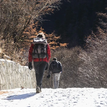
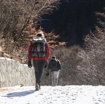
I shouldered my heavy pack and officially began my high-altitude, heavy-load trek. At over 3,900 meters, the trail was all uphill. Just yesterday I was in Hangzhou; now I was gasping for breath, forced to adjust my pace and breathing. The two other hikers, carrying light packs, moved quickly. I thought I would definitely fall behind, but I managed to keep up, barely. Speed was tiring, but having company pushed me forward.
H2: FAQ: High-Altitude Trekking in Daocheng Yading
Q1: What is the best time to visit Daocheng Yading for trekking?
A: The best time is late autumn (October to early November) for golden leaves and stable weather. Winter (December to February) offers stunning snow views but extreme cold and limited facilities. Spring and summer are green but prone to rain.
Q2: Do I need special permits for trekking in the Three Holy Mountains?
A: No special permits are required beyond the standard scenic area entrance ticket. However, camping inside the park is restricted; you must register with park authorities and follow designated routes.
Q3: How do I prevent altitude sickness in Daocheng?
A: Ascend gradually, stay hydrated, avoid alcohol, and consider acetazolamide (Diamox). Acclimatize for at least one night in Daocheng County (3,700m) before venturing higher. Listen to your body—if symptoms persist, descend immediately.
Q4: What gear is essential for a winter trek in Daocheng?
A: Four-season tent, sleeping bag rated to -15°C, insulated pad, gas stove (not liquid fuel), merino wool layers, down jacket, waterproof shell, trekking poles, crampons, headlamp, and high-calorie food.
Q5: Can I do the trek solo?
A: Yes, but it's risky. Solo trekkers should have prior high-altitude experience, reliable gear, and a satellite phone or personal locator beacon. The park has limited cell coverage, and rescue services are slow in winter.
H2: Conclusion: The Dialogue Continues
Two days and nights under the Three Holy Mountains changed me. Not because I conquered anything—the mountains are unconquerable—but because I learned to listen to the dialogue between my body and will. The body wants comfort, safety, and retreat. The will wants purpose, challenge, and meaning. The trick is not to silence one for the other, but to let them speak, negotiate, and ultimately cooperate.
If you're considering a similar journey, start small. Test your gear. Know your limits. And above all, respect the mountains. They don't care about your plans—they only reveal themselves to those who are prepared.
Ready to plan your own Daocheng Yading adventure? [Link: Book your trekking permit and gear rental] or [Link: Join a guided high-altitude trekking group] to ensure a safe and unforgettable experience.
This article is based on a personal account from Mafengwo. All factual details—elevations, distances, dates, and locations—are preserved. The author's experiences and opinions are their own. Always consult local authorities and current weather conditions before attempting high-altitude trekking.
You may also like