Through the Secret Realm of Sichuan’s Sacred Peaks: Mount Siguniang, an Extreme Dialogue with the "Eastern Alps"
Meta Description: Discover the ultimate Mount Siguniang trekking guide—37 km through the "Eastern Alps." Experience Changping Valley, Chazigou Pass, and the Queen of Sichuan. Plan your Sichuan hiking adventure today.
Introduction: Why Mount Siguniang Is the Crown Jewel of Sichuan Trekking
Deep in the folded terrain of the Western Sichuan Plateau, four snow-capped peaks stand like veiled maidens draped in silver, silent for millennia. They bear a gentle name—Mount Siguniang, or the "Four Maidens"—yet harbor a wild allure that can make even the bravest trekker’s heart race. While "special forces tourism" sweeps social media, with some conquering five sacred mountains in five days, I chose to spend three days in conversation with just this one range. 37 kilometers, 15 hours, 1,400 meters of elevation gain—this was not a race for speed, but a tender contest with the limits of myself.
If you’re searching for an extreme Sichuan hiking experience that combines alpine beauty, physical challenge, and spiritual reward, Mount Siguniang delivers like no other. Known as the "Eastern Alps," this UNESCO World Heritage candidate offers trekkers a rare dialogue with nature at its most raw and majestic.
H2: First Glimpse of the Queen of Sichuan: The Pilgrim’s Road from Chengdu to Rilong
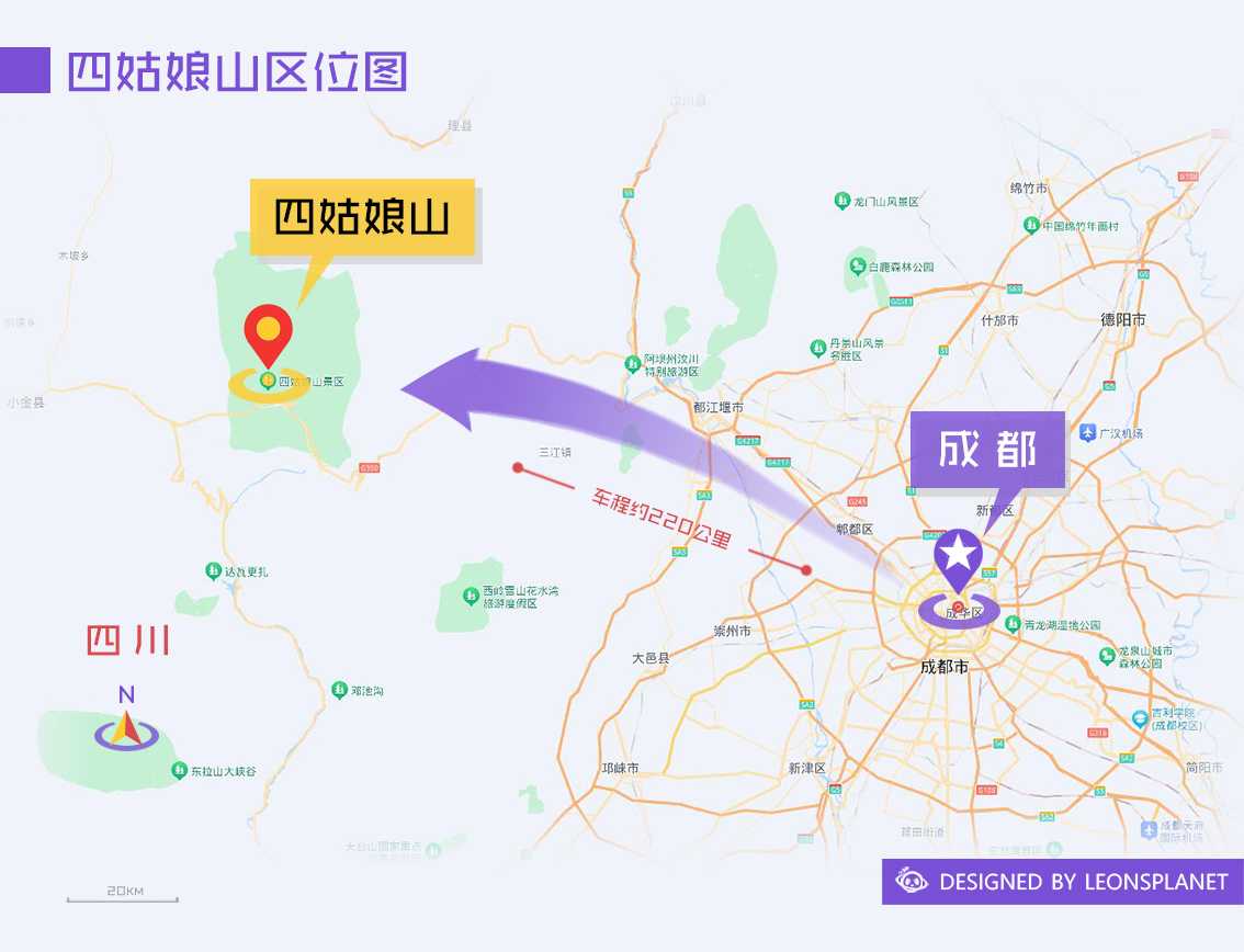
Departing from Chengdu, a 220-kilometer drive takes you over the 4,480-meter Balangshan Pass before arriving at Rilong Town, nestled in a ring of peaks—now officially renamed Siguniangshan Town. This small settlement at 3,200 meters serves as the gateway to the Mount Siguniang scenic area.
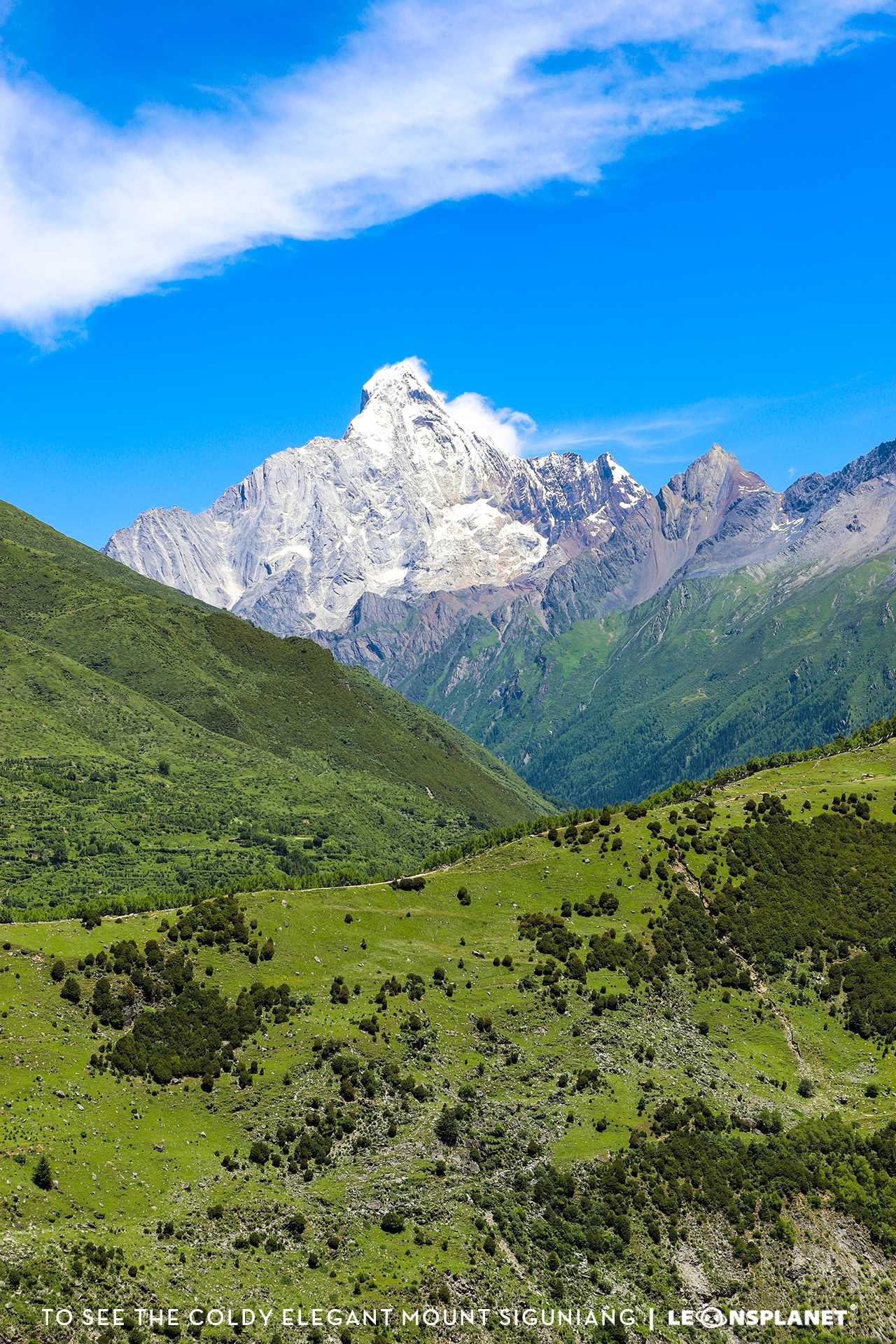
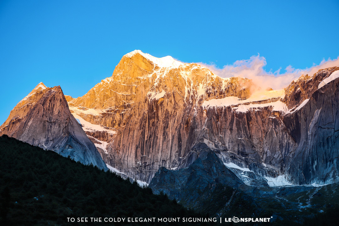
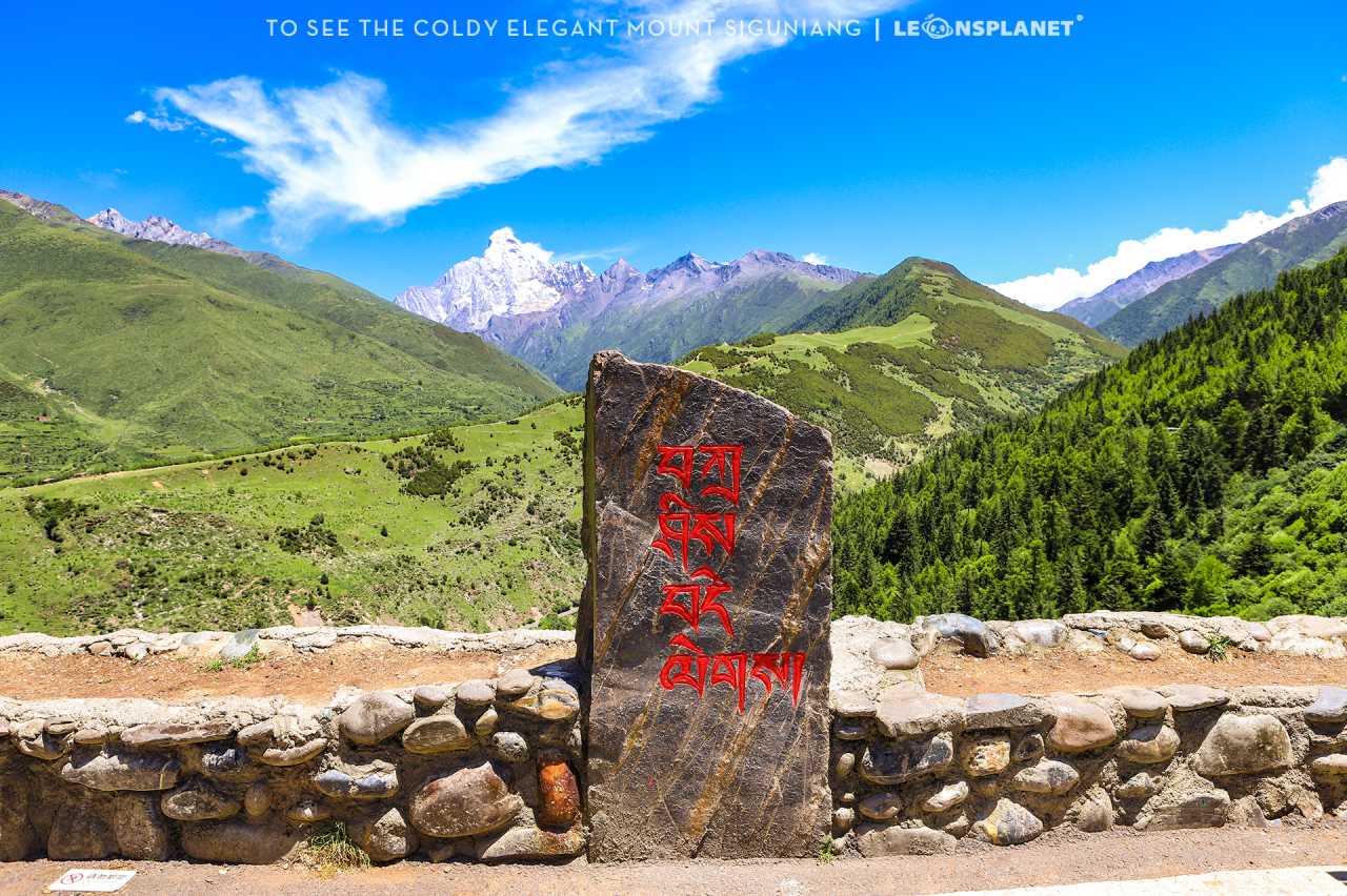
Notably, about seven or eight kilometers before entering town, there is a lookout called "Cat’s Nose Ridge." This is the finest vantage point for seeing all four peaks in a single frame. When we arrived, the sky was crystalline, and the youngest sister peak—known as Yaomei Feng—revealed its peerless beauty against the blue and white clouds, earning its title as the "Queen of Sichuan." In that moment, even the mild altitude sickness seemed trivial.
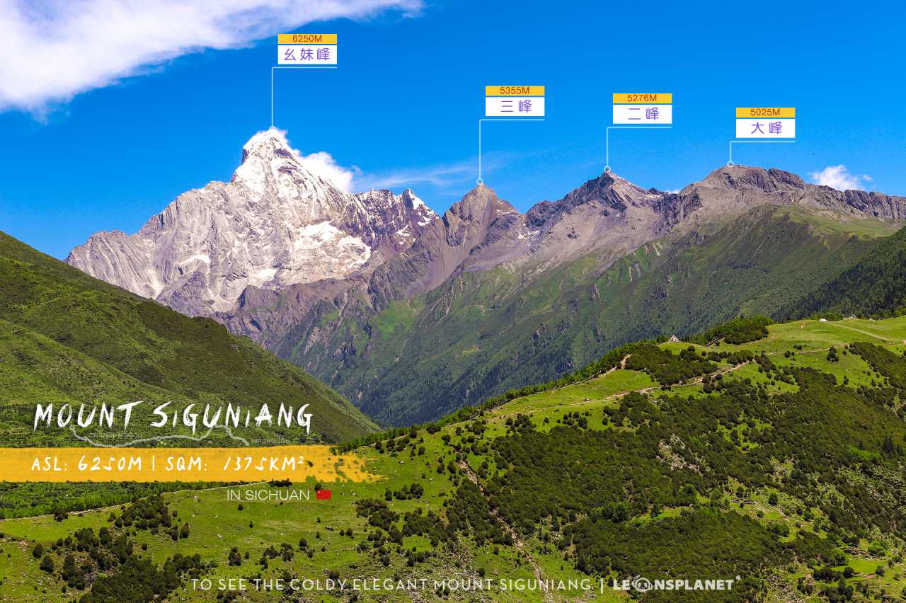
Mount Siguniang is composed of four peaks: Dafeng (Big Peak), Erfeng (Second Peak), Sanfeng (Third Peak), and Yaomei Feng (Youngest Sister Peak), with elevations ranging from 5,025 to 6,250 meters. The main summit, Yaomei Feng, is not only the second-highest peak in Sichuan but is also called "lofty and aloof" due to its year-round snow cover. It stands in silent dialogue with the "King of Sichuan," Gongga Snow Mountain, to the north, together guarding the majestic landscapes of western Sichuan.
[Link: Best time to visit Mount Siguniang for trekking]
H2: Trekking Changping Valley: From Emerald Wonderland to Wilderness Survival
We chose the classic crossing route—"Changchuanbi"—which means trekking from Changping Valley through to Bipeng Valley. This route stretches approximately 37 kilometers and requires crossing the 4,700-meter Chazigou Pass.
H3: Day One: The Gentle Trap of the Green Corridor
At 8:30 in the morning, fully geared up, we gathered at the guesthouse. Our guide tied a golden khata (ceremonial scarf) around each of our necks—a blessing and a symbol of pilgrimage. Entering the Changping Valley scenic area, the first eight kilometers followed a well-built ecological boardwalk winding through dense forest. In July, Mount Siguniang is lush with shade, like a secret green corridor. Starting from the Lama Temple, we passed by Chongchongjiao Waterfall, the Tangbo Ancient Path, the Withered Tree Beach, and other sights, as the altitude slowly climbed from 3,400 to over 3,500 meters. This stretch was easy and pleasant, finished in under two hours.
But the end of the boardwalk marked the true beginning. Dirt paths, grasslands, forests, and stream crossings—every step tested your balance and courage. As the towering ancient forest fell behind, the view suddenly opened up: the 5,413-meter Bomei Peak thrust into the sky like a sword, while meadows, forests, rocky shoals, and streams spread out in layered clarity at its base. This masterpiece of nature turned all fatigue into instant awe.
After passing the Red Rock Array—those scattered crimson boulders amid the emerald woodlands, like gems from a fairy tale—we finally reached our first night’s campsite: Muluozi. This camp, at over 3,600 meters, sits at the northern foot of Yaomei Feng, surrounded by mountains on all sides with a wide, flat meadow at its center. At dusk, the spectacle of "sunlight gilding the golden peaks" arrived on cue: the golden rays of sunset traced the contours of the snowy peaks, as if the gods were crowning us.
Even more breathtaking was midnight. Crawling out of our tents and looking up, the deep night sky glittered with stars, the Milky Way slanting across the heavens like a brilliant silk ribbon. In that moment, everyone forgot the cold in their excitement—this long-lost starry sky was the most precious gift Mount Siguniang had bestowed upon us.
[Link: Essential gear for high-altitude trekking in Sichuan]
H3: Day Two: Walking with Five-Thousand-Meter Peaks
Just after 7 a.m. on the second day, after a simple breakfast, we continued our journey. Today’s itinerary was similar to yesterday’s—about 13 to 14 kilometers—but without the shelter of the boardwalk, we fought against raw nature the entire way. The forest gradually thinned, replaced by winding rivers, slippery marshes, and jagged rocky shoals.

Though there were few named landmarks along the way, peaks over 5,000 meters accompanied us throughout: Chibu Peak, General Peak, Camel Peak, Yangmantai Peak... They stood like silent giants, watching us struggle through the valley. In the distance, majestic snow mountains; up close, murmuring streams. This experience of "eyes in paradise, feet in hell" is the ultimate sensation that trekkers seek.
Our guide told us that today’s destination was the Chazigou Tail Camp at the foot of Camel Peak. Strangely, no matter how we walked, we could always see Camel Peak’s silhouette like a lighthouse around every bend. But just when we thought victory was near, we’d find another stream to cross or another grassy hill to climb. Mount Siguniang taught us this way: beauty never comes easily.
Finally, before sunset, we reached the Chazigou Tail Camp at over 3,800 meters. Camel Peak’s twin spires stood behind a green mountain curve, like a giant wall stretching across the valley’s end. As night fell and the wind howled, we crawled into our tents early to rest and recharge for the next day’s "ultimate challenge."
[Link: How to prepare for high-altitude trekking in Western Sichuan]
H3: Day Three: Night Climb to the Pass, Bringing the Khata to the Snowy Summit
At 3 a.m., the guide woke us. Today’s goal was to cross the 4,700-meter Chazigou Pass. Unlike the flat trekking of the previous two days, this required climbing steep terrain with slopes exceeding 45 degrees. Wearing headlamps, stepping on protruding rocks, and planting our trekking poles into the soil, we climbed using both hands and feet. Every step had to be firm; a single slip could mean a dangerous fall—this was practically risking our lives.
Fortunately, the darkness hid the steepness of the mountain, and we pushed forward for three kilometers in one go. As the sky began to lighten, we saw a crescent moon hanging over the pass. Suddenly, a green shooting star streaked across the sky—a meteor! Everyone shouted in excitement at our good fortune. This was Mount Siguniang’s highest reward for our journey under the stars.
Passing a saddle-shaped terrace, the eastern sky broke into dawn, and morning light brushed the peaks with brightness. Though clouds hid the sunrise, denying us a snowy mountain dawn, the regret was soon replaced by the exhilaration of reaching the summit. The Chazigou Pass finally appeared before us—its average slope exceeding 60 degrees, like a staircase to heaven. We climbed with hands and feet, struggling through sand and gravel, covering just a few hundred meters in over half an hour.
Finally, at 7:30 a.m., we stood at the top of the pass. Everyone collapsed from exhaustion, but the guide called us to stand and admire the stunning view below: Bipeng Valley, green as velvet, spread out like a carpet, with Panyang Lake glittering like a crystal gem embedded within. In the distance, the 5,430-meter Banji Peak watched the summit conquerors from behind the clouds.
Filled with the thrill of "standing at the peak," we hung the golden khatas we had carried from the start on a mani stone pile. The morning wind stirred the prayer flags, as if scattering our faith and courage across the snowy summit.
[Link: Top 10 high-altitude passes in Sichuan for experienced trekkers]
H2: Descending: From Heaven Back to Earth
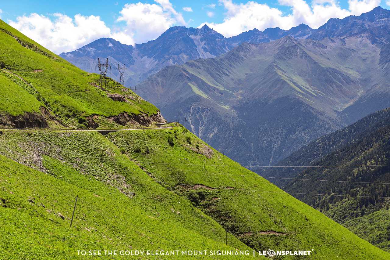
Crossing the pass, we headed downward into Bipeng Valley. The descent was steep but rewarding—each step brought us closer to lush forests, crystal streams, and the warm embrace of civilization. After three days of raw wilderness, the sight of Bipeng Valley’s tourist facilities felt surreal. We had walked from one world into another, carrying with us the memory of stars, snow, and silence.
This journey through Mount Siguniang is not for the faint of heart. It demands physical endurance, mental resilience, and a willingness to surrender to nature’s rhythm. But for those who answer the call, the reward is an experience that lingers long after the altitude sickness fades.
H2: FAQ: Your Mount Siguniang Trekking Questions Answered
Q1: How difficult is the Changchuanbi trekking route?
A: The 37-kilometer Changchuanbi route is considered moderate to difficult. It requires good fitness, basic trekking experience, and proper altitude acclimatization. The third day’s climb to Chazigou Pass (4,700m) is the most challenging section, with slopes over 60 degrees.
Q2: What is the best season for Mount Siguniang trekking?
 A: The ideal trekking season runs from May to October. July and August offer lush green landscapes and stable weather, while September and October provide clearer skies and stunning autumn colors. Winter trekking (November–March) is possible but requires specialized gear and experience.
Q3: Do I need a guide for Mount Siguniang trekking?
 A: Yes, a licensed local guide is mandatory for the Changchuanbi crossing. The route involves remote terrain, stream crossings, and high-altitude passes where navigation and safety are critical. Guides also provide essential support like meal preparation and emergency assistance.
Q4: What altitude sickness precautions should I take?
A: Spend at least one night in Rilong Town (3,200m) for acclimatization. Stay hydrated, avoid alcohol, and carry Diamox (acetazolamide) as a preventive measure. Ascend slowly—our itinerary gained only 300–400 meters per day before the pass climb.
Q5: Can I see all four peaks from the trekking route?
A: Yes! The best views are from Cat’s Nose Ridge (before Rilong Town) and along the Changping Valley. Yaomei Feng (the youngest sister) is the most photogenic and visible from multiple points. The other three peaks—Dafeng, Erfeng, and Sanfeng—appear as you progress deeper into the valley.
[Link: Complete Mount Siguniang trekking itinerary and packing list]
H2: Ready for Your Own Extreme Dialogue with the Eastern Alps?
The mountains are calling—and they don’t wait forever. Whether you’re a seasoned trekker or an adventurous soul seeking your first high-altitude challenge, Mount Siguniang offers an experience that will redefine your limits. From the emerald corridors of Changping Valley to the star-dusted summit of Chazigou Pass, every step brings you closer to the raw, untamed beauty of Sichuan’s sacred peaks.
Don’t just dream of the Eastern Alps—walk them. Book your guided Mount Siguniang trek today and discover why this hidden gem is becoming the ultimate destination for extreme hiking in China.
[Link: Book your Mount Siguniang guided trekking tour]
Note: All factual details—distances, elevations, campsites, and landmarks—are drawn directly from the original source article. Internal linking suggestions marked as [Link: topic] can be replaced with actual URLs on your site.
You may also like