Through Hell for the Body, Heaven for the Eyes: The Ultimate 7-Day Western Sichuan Self-Drive Guide
Meta Description: Discover the ultimate 7-day Western Sichuan itinerary from Chengdu to Daocheng Yading. Conquer altitude sickness, traverse Highway 318, and witness heaven-on-earth landscapes. Expert tips inside.
Introduction: Why Western Sichuan Demands Your Attention
The pandemic may have closed international borders, but it opened our eyes to the staggering beauty within China. For years, I made an annual pilgrimage to the plateau—starting with beginner-friendly Qinghai, graduating to Gannan’s intermediate challenges, and finally summoning the courage to tackle the "last pure land on the blue planet": Daocheng Yading Nature Reserve.
This wasn't just a vacation. It was a conversation with myself. National Highway 318—that legendary road revered as "a must-drive in this lifetime"—felt like an impossible dream for a corporate grind. But dreams do come true. With nine days of hard-won leave, I set out to fulfill the first half of that dream.
"Why would you torture yourself like that?" people ask. The answer is simple: Hell for the body, heaven for the eyes. And the pain of hell can never outweigh the beauty of heaven. The key is how much you believe you can do it.
The Three "Tigers" Blocking Your Western Sichuan Road Trip

Before you hit the road, be honest with yourself. Three formidable challenges await every Western Sichuan traveler.
Time: The Ultimate Luxury on Highway 318
Driving the 318 from Chengdu to Lhasa demands at least 10 days. For photographers and hidden-gem seekers, even 14 days may not suffice. Office workers face the cruelest constraint: time. I cobbled together nine days by shifting shifts around the May Day holiday, taking five days off plus extra leave. Traveling off-peak is non-negotiable—leaving a few days ahead of the crowds is the only way to avoid the masses.
Altitude Sickness: A Test of Willpower
Altitude sickness is no joke. When it hits hard, you feel like you're dying—trapped between "sleeping" and "not being able to sleep," with your mind fixated on one thing: going home. But almost everyone experiences it. The difference lies in willpower. My years of plateau experience taught me this: Don't be afraid, but don't underestimate it. [Link: Altitude sickness prevention tips]
Route Planning: The Explorer's Challenge
National Highway 318 is China's most mature self-driving route, welcoming massive tourist numbers annually. If you want to see scenery others miss, you must take remote roads and explore lesser-known destinations. This requires extensive preparation and reliable travel companions. [Link: Best off-road vehicles for plateau driving]
Day 1: Shuangliu to Xinduqiao – A Winter-Summer Time Travel
From Chengdu to Kangding: The Journey Begins
Our plane landed at Chengdu Shuangliu Airport, and we drove off immediately. Destination: Xinduqiao. We took the expressway to Kangding, then merged onto Highway 318. Road conditions were decent, aside from congestion caused by large trucks passing. Word has it that during peak holiday season, this stretch can gridlock for an entire day.
As we chatted and laughed, the snow mountains gradually revealed themselves. We'd left Tianjin in early-summer weather; now we were looking at snow-capped peaks. When we got out for photos, the temperature had plummeted. We dug out windbreakers, feeling like we'd experienced both summer and winter in a single day.
Zheduo Mountain: The First Pass of Kham
Zheduo Mountain, at 4,298 meters above sea level, is the first major pass in the Kham region and the first checkpoint for altitude sickness. The weather was bad, the air thin. Many people immediately started using oxygen canisters, but we held off—previous plateau experiences had taught us this was part of acclimation. My head hurt a bit, but I pushed through, climbing slowly.
We hadn't seen much snow in the north this year, but we encountered it on Zheduo Mountain. To prevent altitude sickness, walk slowly and avoid psychological pressure. Coming from the plains to the plateau, your body needs time to adjust.
East of Zheduo Mountain is mountainous terrain; to the west lies the eastern Qinghai-Tibet Plateau—the real Tibetan region. From here, the challenge to both willpower and body officially begins.
Accommodation Tip: We chose the Kangding Snowy Region Palace Hotel (康定雪域宫廷酒店)—good facilities, excellent food. But Xinduqiao sits at high altitude, and spending the first night there was genuinely uncomfortable. I took headache medication and spent the first half of the night half-asleep, half-awake.
Day 2: Crossing Mountains, Racing to Daocheng
The Eighteen Bends of the Sky Road: A Giant Serpent Coiling Around the Mountain
Departing from Xinduqiao and heading through Yajiang toward Litang, you'll encounter the Eighteen Bends of the Sky Road (Tianlu Shiba Wan). The road on Jianziwan Mountain looks like it was cut by scissors—at 4,659 meters, it's treacherous and winding.
The weather was perfect today. From the observation deck, we could see snow-capped mountains in the distance. There are three observation decks at different elevations; you can stop at each for photos. From the summit, the road looked like a giant python slithering through the forest.
To capture the full panorama, I flew my drone—a new DJI 2S, my first time flying it on the plateau. I was nervous, but DJI's capabilities are incredible.
Kazila Mountain: The Roof of This Journey
Kazila Mountain, at 4,718 meters, marks the boundary between Litang and Yajiang. This was the highest point of our trip. We got out to feel the biting wind and take commemorative photos. If nobody had told us the elevation, we might not have noticed; but the moment we saw the number on the monument, altitude sickness seemed to hit instantly.
Rabbit Mountain: A Jade Rabbit Descends to Earth
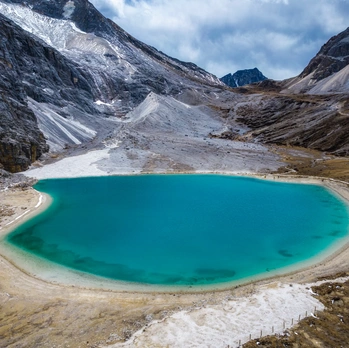
On the way to Daocheng Yading, several rocks look remarkably like rabbit ears, standing firm in the wind. This is Rabbit Mountain (Tu'er Shan), at 4,696 meters. The surrounding landscape features steep glacial erosion formations, as if a frightened little rabbit is staring at you in panic.
Rabbit Mountain is part of the Haizi Mountain Nature Reserve—a relic of ancient glacial landforms left by the Himalayan orogeny. The area is vast and desolate, filled with bizarre rock formations. The reserve contains 1,145 lakes of various sizes, making it unique in China for its density and scale. Because Tibetan people call high-altitude lakes "haizi" (海子), the mountain got its name.
Daocheng White Pagoda: The Power of Faith
The Daocheng White Pagoda, also known as the Victory Stupa (Zunsheng Talin), is called "Langjie Qudeng" in Tibetan. Legend has it that when Shakyamuni Buddha entered nirvana, he instructed the construction of this stupa and personally blessed it. The pagoda sits at the foot of the Daocheng Bridge, with rows of prayer wheels arranged on a square base. Circling mountains, water, and white stupas is a Tibetan custom—walking around three times is a daily ritual performed morning, noon, and evening.
Accommodation Tip: Tonight we stayed in Shangri-La Town (Xianggelila Zhen), at an elevation under 3,000 meters—perfect for recovery.
Day 3: Yading Nature Reserve – The Last Pure Land on Earth
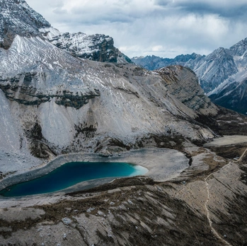
The Sacred Three Mountains: Immortals in the Clouds
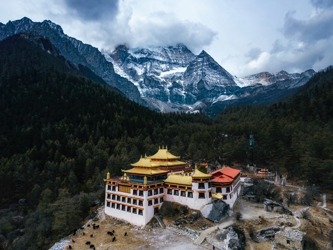
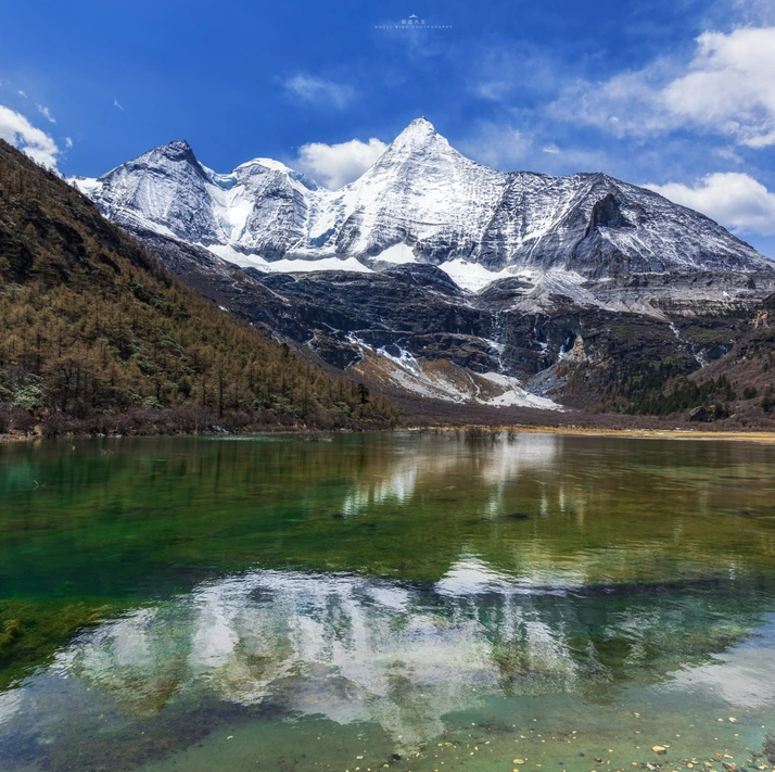
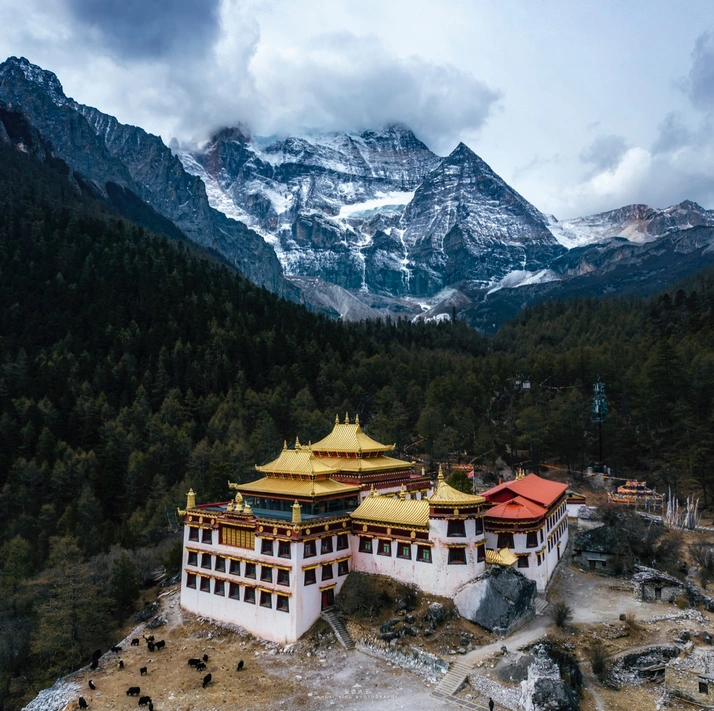
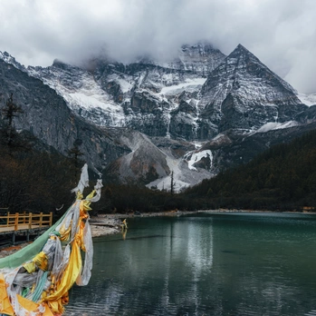
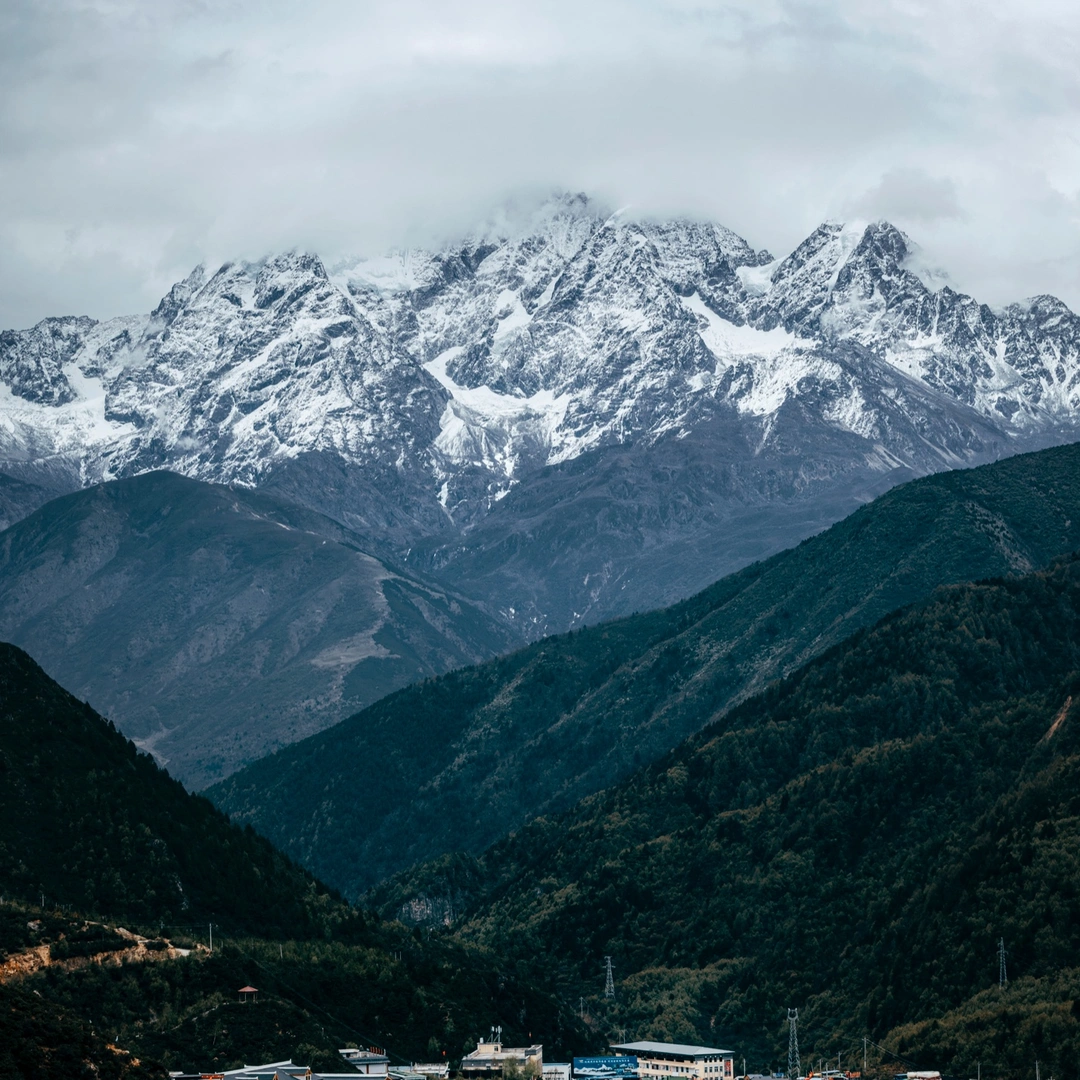
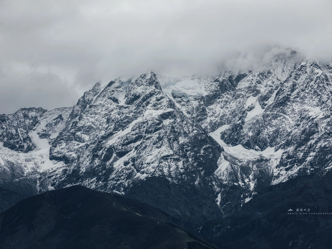
Yading Nature Reserve is the crown jewel of Western Sichuan. The reserve protects three sacred peaks: Xiannairi (仙乃日), Yangmaiyong (央迈勇), and Xianuoduoji (夏诺多吉). Tibetan Buddhists believe these mountains are the dwelling places of bodhisattvas.
We arrived at dawn. The morning light painted the snow-capped peaks in gold—a sight that made every breathless step worthwhile. The elevation here exceeds 4,000 meters, but the beauty is so overwhelming that you forget the pain.
The Milk Lake: A Turquoise Gem in the Mountains
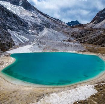
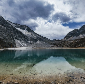
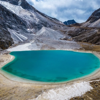
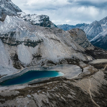
The hike to Milk Lake (牛奶海) is grueling—steep, rocky, and oxygen-deprived. But when you finally reach this turquoise lake at 4,600 meters, surrounded by snow-capped peaks, you understand why people call this "heaven for the eyes."
Pro tip: Start early, bring plenty of water, and take breaks every 20 steps. Your body will thank you.
The Five-Color Lake: A Palette from the Gods
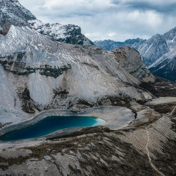
Five-Color Lake (五色海) sits even higher at 4,700 meters. The lake's colors shift with the light—deep blue, emerald green, and purple hues dancing across the surface. It's said that the lake reflects the five wisdom Buddhas.
Day 4-7: Hidden Gems and Return Journey
Litang: The City of the Sky
Litang (理塘), at 4,014 meters, is known as the "City of the Sky." This is the hometown of the Sixth Dalai Lama, Tsangyang Gyatso, and the setting for the hit TV series "To the Sky Kingdom." The Litang Horse Racing Festival in August is legendary.
Tagong Grassland: Tibetan Pastoral Paradise
Tagong Grassland (塔公草原) offers sweeping views of yaks, prayer flags, and the sacred Yala Snow Mountain. The Tagong Monastery is a must-visit, with its golden roof glinting against the blue sky.
Hailuogou Glacier: Where Ice Meets Forest
Hailuogou Glacier (海螺沟) is one of the lowest-elevation glaciers in the world. You can walk right up to the glacier tongue and feel the ancient ice. The hot springs here are a perfect way to soothe sore muscles after days of hiking.
Practical Tips for Your Western Sichuan Adventure
Altitude Sickness Prevention
- Ascend gradually – Don't fly directly to high-elevation destinations
- Stay hydrated – Drink 3-4 liters of water daily
- Avoid alcohol – It worsens symptoms
- Consider medication – Acetazolamide (Diamox) can help
- Listen to your body – If symptoms persist, descend immediately
Essential Packing List
- Layered clothing (temperatures range from 5°C to 25°C)
- Windbreaker and rain jacket
- Sunscreen (SPF 50+)
- Sunglasses and hat
- Headlamp for early morning hikes
- Portable oxygen canisters
- First-aid kit with altitude sickness medication
Best Time to Visit
- May-June: Wildflowers bloom, fewer crowds
- September-October: Autumn colors, stable weather
- Avoid July-August: Rainy season, landslides possible
FAQ: Your Western Sichuan Questions Answered
Q1: Is it safe to drive Highway 318 alone?
Yes, but only if you have experience driving mountain roads. Road conditions vary, and weather can change rapidly. Consider hiring a local driver if you're not confident.
Q2: How much does a 7-day Western Sichuan trip cost?
Expect to spend 3,000-5,000 RMB per person including transportation, accommodation, food, and entrance fees. Peak season costs more.
Q3: Can I visit Yading Nature Reserve in one day?
Technically yes, but you'll miss the best hikes. Two days is ideal—one for the short route to Chonggu Monastery, one for the long route to Milk Lake.
Q4: What should I do if I get severe altitude sickness?
Descend immediately. Symptoms like confusion, inability to walk, or coughing up fluid require emergency evacuation. Carry a pulse oximeter and monitor your oxygen saturation.
Q5: Do I need a permit for Western Sichuan?
Most areas are open to domestic tourists. Foreign travelers need a Tibet Travel Permit for certain areas near the border. Check current regulations before departure.
Conclusion: Your Western Sichuan Dream Awaits
Western Sichuan is not a destination—it's a transformation. Every aching muscle, every gasping breath, every moment of doubt is rewarded with vistas that defy description. The snow-capped peaks, turquoise lakes, and golden stupas will stay with you long after you return to sea level.
This journey taught me that the body's limits are negotiable, but the soul's hunger for beauty is not. Hell for the body, heaven for the eyes—and the heaven will always win.
Ready to plan your own Western Sichuan adventure? Start by booking your flights to Chengdu and securing a reliable 4WD vehicle. The road is waiting. [Link: Book your Western Sichuan tour package]
Have you driven Highway 318 or visited Daocheng Yading? Share your experience in the comments below!