Standing at the Border of Grandeur and Distance: Your Ultimate Xinjiang Travel Guide (2024 Update)

Meta Description: Discover the magic of Xinjiang in this SEO-optimized travel guide. From the "last tear of the Atlantic" Sayram Lake to the awe-inspiring Dushanzi Grand Canyon, learn safety tips, travel logistics, photography gear, and insider advice for an unforgettable journey through China's wild northwest.
Introduction: A Promise Ten Years in the Making
At twenty, I was curled up in a hard-sleeper compartment of a green train, flipping through an old magazine when I came across the words of Liu Liangcheng. With his pen, he sketched a Xinjiang I had never imagined—a place of sweeping livestock migrations, the delicate interplay of windblown sand and oasis, the deep murmur of life and language beneath the vast sky. Tears blurred the print. Ten years later, carrying In Xinjiang in my backpack, I finally set foot on the soil that had once made my youth weep with longing.
This is not just a travelogue. It's a practical, SEO-optimized guide for anyone dreaming of exploring Xinjiang—the largest autonomous region in China, where distances are vast, sunsets come at 10 PM, and every canyon tells a story of geological time.
[Link: Best time to visit Xinjiang] [Link: Xinjiang travel safety tips]
Is Xinjiang Safe? Your Top Travel Concerns Answered

Safety in Xinjiang: Safer Than You Imagine
This is the first question everyone asks. My answer: Xinjiang might be the safest place in China. Police booths appear every hundred meters. Security checks greet you at hotels, scenic spots, and shops. ID card scans—and even facial recognition—are standard when entering or leaving cities.
The most unique experience? Passengers are not allowed inside gas stations. Whether it's howling wind or pouring rain, the driver pulls in alone to refuel while everyone else must walk around to the exit. It sounds tedious, but it brings peace of mind.
Are Locals Friendly?
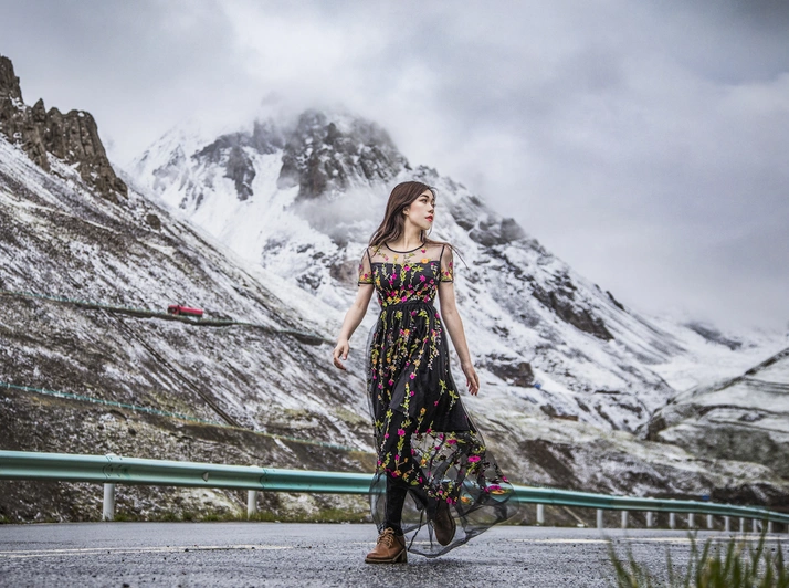
Every place has warm people and cold ones. Most people I met in Xinjiang were genuinely kind: a woman invited me into her shop to shelter from rain; a guesthouse owner insisted we stay for a meal; a stranger stared at my dress and said, in halting Mandarin, "Pretty." Of course, there was also the security guard who lied about the parking lot having no restroom—but my travel companion had already slipped in.
Pro tip: Respect local customs. A smile is your best passport.
Xinjiang Travel Logistics: What You Need to Know
Does the Sun Really Set at 10 PM?
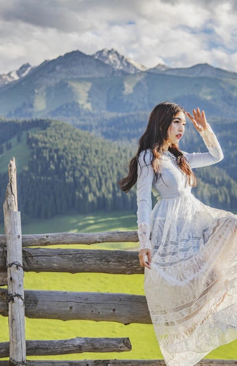
Yes. Xinjiang runs two to three hours behind Beijing time. During the summer solstice, you'll wait until after 10 PM for the sky to surrender its last glow. Even in August, sunset comes around 9 PM.
The upside: You can start your day at 10 AM.
The downside: If you wake at 5 AM for sunrise, your day becomes impossibly long—but also impossibly fulfilling.
How Far Apart Are the Distances?
Xinjiang is China's largest autonomous region—bigger than you can imagine. In twelve days, we covered 4,000 kilometers. Driving 400 to 500 kilometers a day is routine.
The real challenge? Section-based speed enforcement. A single road is divided into multiple checkpoints (A, B, C, D), and you cannot exceed the limit at any point. So even if the mileage isn't huge, you'll spend hours in the car. Come to Xinjiang prepared for a sore back and stiff legs.
How to Get Around: Chartering a Car is King
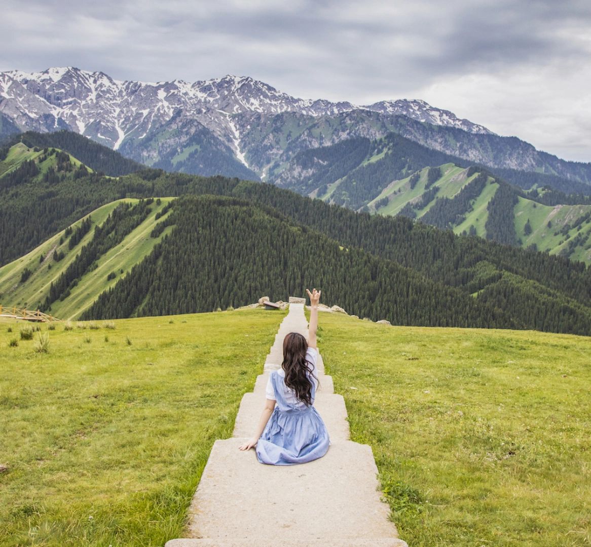
Poor signal, tricky roads, and dense speed traps make self-driving a nightmare for beginners. Hiring an experienced driver is your best bet. The driver I worked with was from "Red Sun," a team I'd met earlier on Lake Baikal. They have a fleet in Xinjiang and know the routes and scenery inside out.
[Link: Xinjiang car rental vs charter] [Link: Best Xinjiang road trips]
Is the Phone Signal Really That Bad?
Yes, very bad. Xinjiang has shut down 4G across the entire region. Currently, only Dushanzi, Kuitun, and Karamay have stable signal. In downtown Urumqi, you're stuck with 3G. In mountainous areas and small towns, it often drops to 2G or nothing. China Unicom and China Mobile are about the same—Unicom is slightly better, but only slightly. Prepare for digital detox.
Camera Gear for Xinjiang Photography
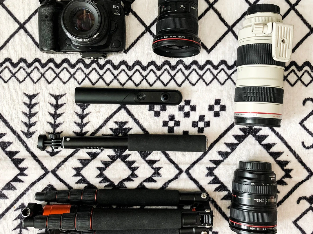
This trip I brought a Canon 5D4 with 24-105mm and 70-200mm as main lenses, occasionally switching to a 50mm f/1.4 and 16-35mm. I also carried a Qoocam 360 camera—it made for fun selfies, whether handheld, on a selfie stick, or placed on the ground. The results were surprisingly good.
Recommended gear: - Wide-angle lens (16-35mm) for sweeping canyon panoramas - Telephoto lens (70-200mm) for capturing intricate ravine details - 360 camera for creative selfies and immersive shots
[Link: Best cameras for landscape photography] [Link: Xinjiang photography tips]
Two Stunning Grand Canyons in Xinjiang
Hongshan Grand Canyon: A Quiet Spectacle
My flight was delayed, so I didn't land in Urumqi until noon the next day. No time to linger—I headed straight for Dushanzi. On the way, we stopped in Shawan for a plate of 大盘鸡 (big plate chicken) that had been featured on A Bite of China. Worth the detour.
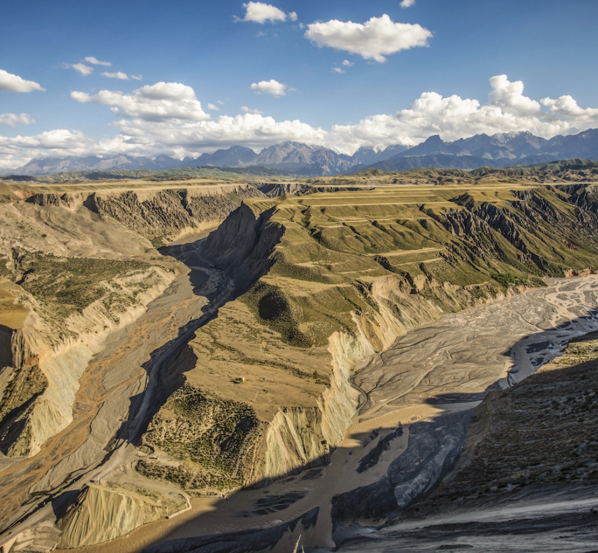
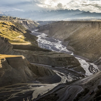
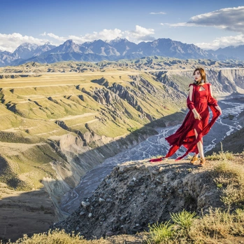
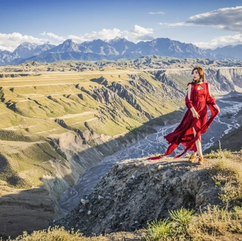
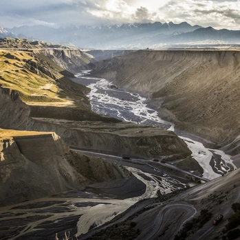
By afternoon, I reached Hongshan Grand Canyon. Undeveloped, unmarked, with few visitors—but praised by foreign explorers and recommended by National Geographic. Nature's chisel had carved out a valley of vivid colors and layered terraces, perfect for both landscape and portrait photography. My red dress found its perfect match here.
I used a wide-angle lens for sweeping panoramas and a telephoto to capture the intricate details of the ravines and rock faces—jagged cliffs layered against distant stone mountains. At the bottom of the canyon, what looked like a mine sent trucks in and out, kicking up dust that caught sunlight in a Tyndall effect, creating a unique hallmark of Hongshan.
Dushanzi Grand Canyon: Standing on the Shoulder of the Abyss
The next day, we headed to Dushanzi Grand Canyon. On the way, I spotted military units on field training exercises and snow-capped mountains in the distance. The canyon was also undeveloped, though a boardwalk had been built. Walking down to the bottom under the blazing sun was exhausting—but the photos made it worthwhile.
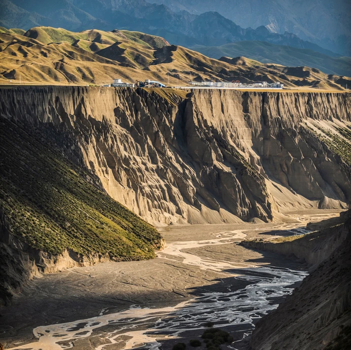
This canyon was carved by the Kuitun River as it burst out of the Tianshan Mountains, slicing through the sloping plain southwest of Dushanzi. The cliffs are sheer and imposing, creating a stark visual contrast with the vast grasslands. Standing at the canyon's shoulder, I listened to the murmuring river and gazed at the crisscrossing ravines.
Our driver said, "Xinjiang is full of canyons. The variety of landscapes here is mind-blowing—it rivals the Grand Canyon in Colorado." The very first sight left me speechless.
[Link: Grand Canyon vs Dushanzi Canyon comparison] [Link: Best canyons in Xinjiang]
The Last Tear of the Atlantic: Sayram Lake
Leaving the canyons, we drove 300 kilometers west to Sayram Lake. Known as "the last tear of the Atlantic," this alpine lake sits at 2,000 meters above sea level. Its water is crystal-clear and deep blue, surrounded by vast grasslands that bloom with wildflowers in summer. A 90-kilometer road circles the lake, offering close-up views of the high-altitude lake and snowy peaks.
Private cars are allowed inside—pay 70 yuan for a ticket and start your lake loop. Compared to Qinghai Lake or Yamdrok Lake, the road here stays much closer to the water, making for a better visual experience. It's easy to pull over and snap photos anytime.
The weather was lousy when I arrived—strong winds, dark clouds. But the bad weather actually gave the photos a dramatic edge—though the wind nearly blew me away. Layered clouds reflected on the lake and mountains, so beautiful I forgot the cold. A patch of yellow grass by the roadside gave the whole scene a New Zealand vibe.
The 90-kilometer loop offered nonstop scenery. On the western side, I found lakeside woods and flower beds—the classic Sayram view. Even without blue skies, it was stunning. I took a photo in a field of blooming flowers, then used the Qoocam for two cool panoramic shots. The camera has a flat bottom, so on level ground you can just set it down. But on the rocky lakeshore, it kept tipping over—I had to prop it up with three stones. Haha, part of the fun.
[Link: Sayram Lake vs Qinghai Lake] [Link: Best alpine lakes in China]
Frequently Asked Questions About Xinjiang Travel
1. Is Xinjiang safe for solo female travelers?
 Yes. With police booths every 100 meters and security checks everywhere, Xinjiang is statistically one of the safest regions in China. However, always respect local customs, dress modestly, and avoid isolated areas after dark.
2. What is the best time to visit Xinjiang?
Late May to October is ideal. Summer (June-August) offers long daylight hours and green grasslands. September-October brings stunning autumn colors. Winter is harsh but offers unique snow landscapes.
3. Do I need a special permit to travel in Xinjiang?
 Most areas are open to domestic and international tourists. However, some border regions (e.g., Kashgar's Pamir Plateau) require a Border Defense Permit. Check with local authorities before traveling.
4. How do I handle the time zone difference?
Xinjiang uses Beijing time (UTC+8) officially, but local life follows a "Xinjiang time" (UTC+6) pattern. Meals and business hours are typically 2-3 hours later than eastern China. Adjust your schedule accordingly.
5. What should I pack for Xinjiang?
- Sunscreen and sunglasses (high altitude, strong UV)
- Layers (temperature swings from 5°C to 35°C)
- Comfortable walking shoes
- Power bank (limited charging opportunities)
- Cash (ATMs can be scarce in remote areas)
Final Thoughts: Why Xinjiang Deserves a Place on Your Bucket List
Xinjiang is not a destination—it's an experience. It's the feeling of standing at the edge of a canyon carved by ancient rivers, watching clouds cast shadows over grasslands that stretch to the horizon. It's the taste of hand-pulled noodles in a roadside diner, the warmth of a stranger's smile, the exhaustion of a 400-kilometer drive that ends with a sunset that lasts an hour.
I knew then—this would not be the first time. I would return again and again, until I had seen every stretch of its endless winds and smoke.
Ready to plan your own Xinjiang adventure? Start with our comprehensive Xinjiang travel checklist, or contact a trusted local driver for a customized itinerary. [Link: Xinjiang travel planning guide]
Your turn: Have you visited Xinjiang? What was your most memorable experience? Share in the comments below, or DM me for personalized trip recommendations.
This article is part of a serialized travelogue. Follow for upcoming posts on Turpan, Kuqa, and the deserts of southern Xinjiang.
You may also like