Over the Hills: Western Sichuan – The Ultimate 13-Day Self-Drive Photography Loop & High Altitude Sickness Survival Guide
Meta Description:
Explore Western Sichuan's 4,000m wonders on a 13-day self-drive photography loop. Includes Seda high altitude sickness guide, panda encounters, and National Highway 318 tips. Start your journey here.
Introduction: Why Western Sichuan Should Be on Every Photographer's Bucket List
Three years after graduation, spontaneous trips have consumed the better part of my youth. Friends always ask, "How do you have so much time to travel? What about work?" The truth is, the urge to set off often strikes in an instant. Some people shuttle between cities, their days and nights reversed; others choose to head for the mountains, seeking a different way of living. There's no right or wrong—just each person's pursuit of a different quality of life.
At the end of 2019, I decided to wish myself a happy birthday with a 13-day self-drive trip through Western Sichuan. Heading toward an altitude of 4,000 meters, traversing the grandeur of mountains and rivers, cleansing the mind and soul. Driving the entire way, facing dangers one by one. In this article, I'll share my personal methods for dealing with altitude sickness and breathing techniques, hoping to help those who fear the effects of high altitude.
Destination: Western Sichuan
Travel Dates: November 3, 2019, 10 days total
Cost per Person: Approximately XXXX RMB (varies by individual spending)
Travel Companions: Friends
Quick Preview: The Beauty of Western Sichuan, a Glimpse for a Lifetime
Here are a few scenic snapshots to give you a taste of Western Sichuan's charm:
- Moshi Park: That classic "panda photo"—you know the one!
- Zheduo Mountain Viewing Platform: The awe-inspiring sight above a sea of clouds
- Seda Larung Gar Five Sciences Buddhist Academy: The land of faith with its red houses
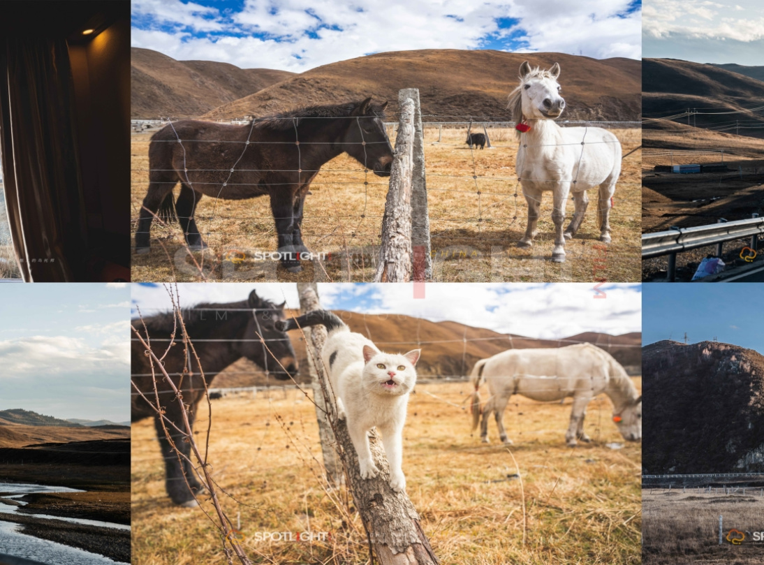
- Tagong Grassland: Adorable horses and a little white cat, like something out of a fairy tale
Part 1: National Highway 318 & Self-Driving in Western Sichuan: Essential Pre-Trip Reading

National Highway 318: China's Most Beautiful Scenic Highway
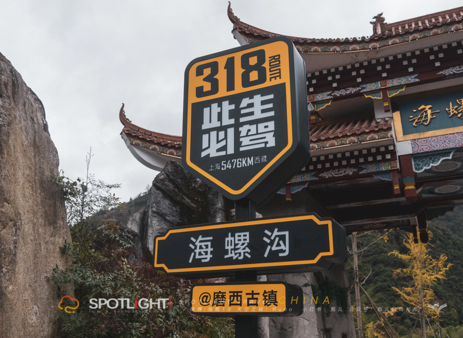
Stretching 5,476 kilometers, National Highway 318 starts in Shanghai and ends in Tibet, spanning eastern, central, and western China. Along the way, it encompasses plains, hills, basins, mountains, and plateaus—from the water-town culture to Tibetan traditions, from flatlands to towering gorges. It's breathtakingly beautiful. This time, we accidentally drove a small section of it, passing through Hailuogou and Moxi Ancient Town. If you ever get the chance, you must drive the full 318 route. The sheer awe is beyond words.
[Link: Best photo spots along National Highway 318]
Safety Tips for Self-Driving in Western Sichuan
The terrain in Sichuan is complex, with a higher chance of landslides and falling rocks, especially during the spring and summer rainy and flood seasons when mudslides and rockfalls are common. When driving, please note:
- Maintain a safe following distance, especially from large trucks
- Don't get distracted while driving; keep your eyes on the road ahead
- Frequently observe the mountain slopes and road surface conditions
- Have your co-pilot help keep watch too—safe travels for everyone
Part 2: The Six-Syllable Mantra: A Symbol of Tibetan Faith
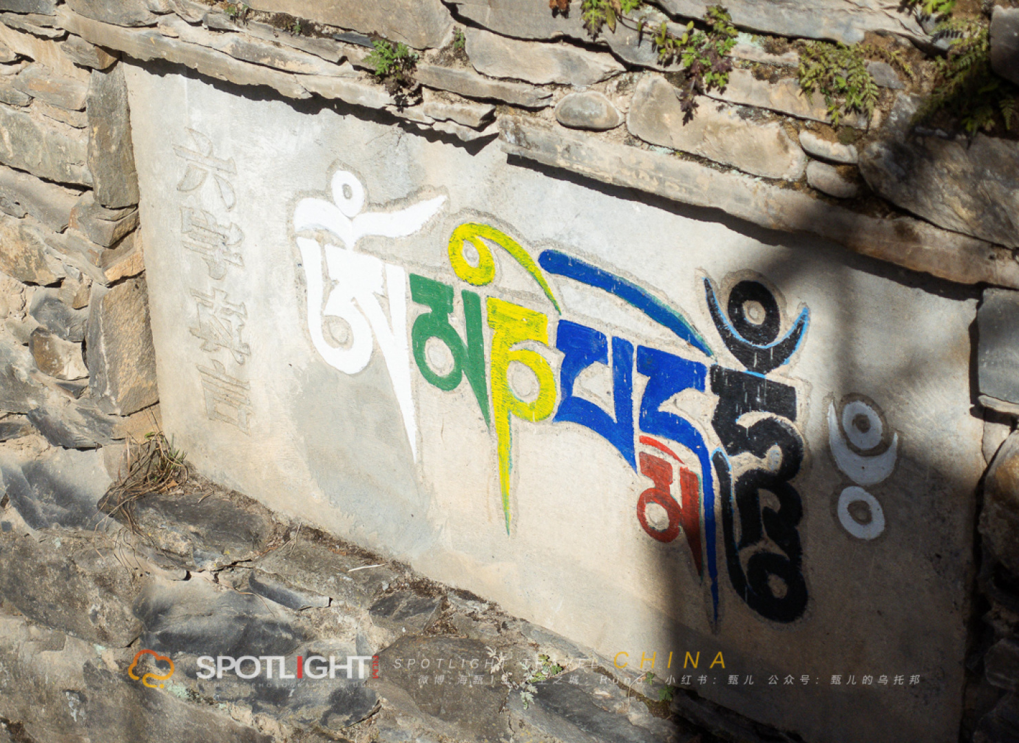
The Six-Syllable Mantra (ॐ मणि पद्मे हूँ)
Modern Chinese pronunciation: ōng (唵) ma (嘛) nī (呢) bēi (叭) mēi (咪) hōng (吽)
Meaning: Great wisdom, great compassion.
On the road to Jinchuan Guanyin Bridge, Seda, and Tagong Grassland, you'll see stones carved with Tibetan script everywhere. Tibetan people believe that spiritual practice requires diligent chanting, reciting scriptures whether sitting or lying down. These stone inscriptions are marks of faith and serve as spiritual guides along the journey.
[Link: Understanding Tibetan Buddhism for travelers]
Part 3: Chengdu: A City Where Vibrancy and the Old Intertwine
Flying from Zhuhai to Chengdu, I only realized I'd booked the wrong date—a ticket for December 3rd. I quickly changed it. My friends were already waiting for us in Chengdu, while we could only helplessly wait for the afternoon flight.
My impression of Chengdu is limited to the road from the airport to the homestay. Though we only stayed one night, the evening was remarkably quiet. Everyone says Chengdu's hotpot is delicious. After landing at 8 p.m., we immediately went looking for food to excite our taste buds. Unfortunately, the restaurant we found wasn't great—maybe the atmosphere at the table just wasn't right.

The homestay in Chengdu had the most exquisite design I've ever seen. Like many cities, Chengdu has its own rhythm of life. At 8 p.m., cars with flashing lights streamed through the streets. The city gradually shed its hustle and bustle, and everyone working away from home headed in the direction of home.
After dinner, we split up. Our friend had to work overtime, so the two of us with "nothing to do" strolled back slowly. On the way, we spotted freshly squeezed sugarcane juice. It was nearly 11 p.m., and the vendor was still waiting for his last customer. We waved him over, bought a cup, and it washed away the greasy taste from before.
[Link: Best homestays in Chengdu for photographers]
Part 4: Setting Off: From Wenchuan to Wolong
Day 1: Departure, Heading into the Unknown
We rented a car through a platform. In the morning, we split up with our friends: we went to pick up the car, while the other two went to the supermarket for supplies. On the morning streets, people were starting their workday, and all kinds of bicycles zipped by. Our homestay was in the city center, with a row of seafood shops downstairs—rarely do you see such a long line of shops in a city.
Leaving Chengdu, we followed the navigation toward Wenchuan and Barkam. It was an overcast day, the sky a gloomy gray. On the highway, rain began to fall. Birds flying up from the woods seemed to tell the story of the earthquake years ago. The deeper we went, the more the mountains began to reveal themselves. Peaks shrouded in clouds looked like a Chinese ink painting. Once again, we were setting off to explore the unknown forests.
Wolong China Giant Panda Garden: Healing Time with Round, Cuddly Pandas
We originally planned to see the pandas on the way back, but due to our companion's limited time, we decided to go right away!
Wolong China Giant Panda Garden Shenshuping Base
- Address: Gengda Town, Wolong Nature Reserve, Wenchuan County, Aba Prefecture
- Self-Drive: Directly navigate to "四川卧龙中华大熊猫苑神树坪基地" (Sichuan Wolong China Giant Panda Garden Shenshuping Base). The road is straightforward and easy to find.
- Bus: From Chengdu Chadianzi Bus Station (departs at 1:30 p.m.) to Gengda Town (37 RMB); or first go to Dujiangyan (17 RMB), then transfer to Gengda (departs at 3:00 p.m., 28 RMB)
- Ticket Price: 79 RMB for adults
- Opening Hours: 9:00 a.m. – 5:00 p.m. (last entry at 4:30 p.m.)
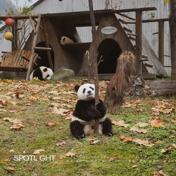
We rushed in to buy tickets just before closing time. Pandas spend 41% of their day sleeping. Their most active times are 9:00–11:00 a.m. and 2:30–5:00 p.m., when they eat bamboo shoots and drink their milk formula. When we arrived, they were playing, tumbling around, and munching on bamboo—so cute you'd wonder if they were people in costumes!
It was drizzling and cold, but seeing the pandas' round, chubby forms made it all worth it. Giant pandas are solitary animals, and each one in the back area has its own space. Their seductive sitting poses and lazy eating habits made you want to squeeze them.
By 5 p.m., the crowd had dispersed, and the weather turned even gloomier. We decided to head to the commercial street near the Wenchuan Memorial for dinner. We checked in for the night at Miyaluo Town, a two-hour drive from Wenchuan. With an experienced driver leading the way, even the darkest roads held no fear.
[Link: Best time to visit Wolong Panda Base]
Part 5: Bipenggou: A Symphony of Ice and Sunlight

Miyaluo Town: A Morning Surprise
We stayed overnight in Miyaluo Town. The hotel was a bit hard to find, but the morning view made up for it. Waking up to misty mountains and the sound of a nearby stream was pure magic. Bipenggou, known for its autumn colors and winter ice, greeted us with a crisp, clear sky. The temperature was below freezing, but the sunlight filtering through the trees created a kaleidoscope of colors.
Bipenggou is a lesser-known gem compared to Jiuzhaigou, but equally stunning. The icefalls and frozen lakes in November are a photographer's dream. We spent the morning capturing the interplay of ice and sunlight—each frame a masterpiece.
[Link: Bipenggou vs Jiuzhaigou – Which is better for photography?]
Part 6: Seda Larung Gar Five Sciences Buddhist Academy: The Land of Faith
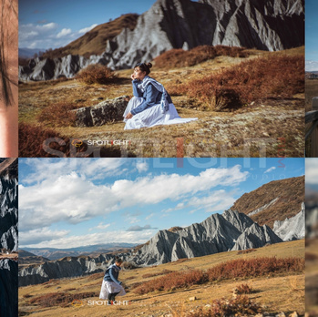
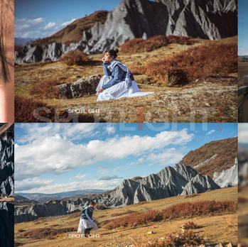
A Spiritual Journey at 4,000 Meters
Seda is the heart of Tibetan Buddhism in Western Sichuan. The red houses clinging to the hillside are a sight to behold. But altitude sickness is a real concern here. At 4,000 meters, oxygen levels are low, and the body needs time to acclimatize.
My High Altitude Sickness Survival Guide:
- Acclimatize gradually: Spend a night at 3,000m before heading to 4,000m.
- Hydrate constantly: Drink at least 3 liters of water per day.
- Avoid alcohol and heavy meals: They worsen symptoms.
- Use Diamox (acetazolamide): Consult your doctor before traveling.
- Breathing technique: Inhale deeply through your nose for 4 seconds, hold for 4 seconds, exhale through your mouth for 6 seconds. Repeat 5 times whenever you feel dizzy.
Seda Larung Gar Five Sciences Buddhist Academy
- Altitude: 4,000m
- Best time to visit: Dawn or dusk for golden hour photography
- Entry: Free, but register at the visitor center
- Photography note: Respect the monks and nuns—ask before taking portraits
[Link: Seda travel guide – what to pack for high altitude]
Part 7: Tagong Grassland & Zheduo Mountain: A Photographer's Paradise
Tagong Grassland: Horses, Cats, and Fairy Tales
Tagong Grassland is where the sky meets the earth. The horses are gentle, and a little white cat followed us around like a scene from a Studio Ghibli film. The grassland is dotted with prayer flags and yak herds—perfect for wide-angle landscapes.
Zheduo Mountain Viewing Platform: Above the Sea of Clouds
At 4,298 meters, Zheduo Mountain offers a sea of clouds that stretches to the horizon. The viewing platform is a short drive from the main road. Sunrise here is unforgettable—the golden light hitting the cloud tops is pure magic.
[Link: Best photography spots on Tagong Grassland]
FAQ: Western Sichuan Self-Drive & High Altitude Sickness
Q1: What is the best time to drive Western Sichuan?
 A: Late autumn (October–November) offers the best colors and stable weather. Spring (April–May) has blooming flowers but more rain.
Q2: How do I prevent altitude sickness in Seda?
A: Acclimatize for 2 days at lower altitudes (3,000m), stay hydrated, avoid alcohol, and use the breathing technique described above.
Q3: Is it safe to drive National Highway 318 alone?
 A: Yes, but drive cautiously, especially during rainy season (June–August). Always check road conditions before departing.
Q4: Can I see pandas at Wolong year-round?
A: Yes, but the best viewing times are 9–11 a.m. and 2:30–5 p.m. when they are most active.
Q5: What camera gear should I bring for Western Sichuan photography?
A: A wide-angle lens (16-35mm) for landscapes, a telephoto lens (70-200mm) for wildlife, and a tripod for low-light shots.
Call to Action: Start Your Western Sichuan Adventure Today
Western Sichuan is more than a destination—it's a transformation. From the red houses of Seda to the icefalls of Bipenggou, every mile reveals a story. Whether you're a photographer seeking the perfect shot or a traveler craving spiritual renewal, this 13-day self-drive loop delivers.
Ready to plan your trip?
[Download our free Western Sichuan itinerary checklist]
[Book a rental car with altitude-ready vehicles]
[Connect with local guides for Seda acclimatization tips]
Your 4,000-meter adventure awaits. Pack your camera, breathe deep, and drive into the unknown.
Follow me on Weibo: 海甄19 RUNO_LI | Studio: ZEN
Photography & Travel Writer | Specializing in high-altitude self-drive itineraries
You may also like