Sichuan West’s Hidden Realm: Trekking the洛克 Line – Five Days and Four Nights to the Ultimate Beauty of Daocheng Yading
Meta Description:
Discover the ultimate Daocheng Yading trekking experience on the洛克 Line. This five-day, four-night guide covers altitude preparation, gear, itinerary, and hidden gems. Plan your sacred mountain pilgrimage today.
Introduction: Why the洛克 Line Is the Trek of a Lifetime
Some journeys demand courage before they even begin. When I told friends I was hiking the洛克 Line—a 61-kilometer route through western Sichuan’s most remote wilderness—their reactions were a mix of awe and concern. No cell signal, no supply shops, only the raw elements of the plateau: biting winds, sudden snow squalls, and passes above 4,700 meters.
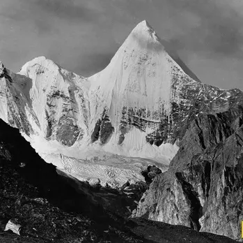
But it is precisely this uncertainty that transforms the洛克 Line into a pilgrimage. Over five days and four nights, you will circle three sacred mountains—仙乃日 (Chenresig), 央迈勇 (Jampelyang), and 夏诺多吉 (Chana Dorje)—moving from their rear slopes to their front faces, completing a journey that mirrors ancient Tibetan devotion.
Now, a month after that trek, every step—the altitude headaches, the camaraderie, the untouched landscapes—confirms this: the洛克 Line is the purest encounter with Daocheng Yading’s ultimate beauty.
H2: Understanding the洛克 Line – From History to Trail

H3: What Is the洛克 Line?
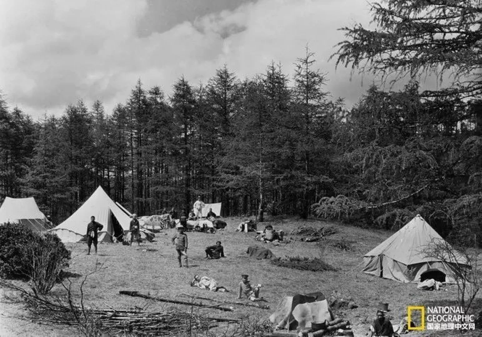
Western Sichuan’s landscapes are legendary, but Muli County remains a hidden realm. In 1922, Austrian-American explorer Joseph Rock ventured here, publishing its breathtaking scenery in National Geographic. His accounts inspired James Hilton’s Lost Horizon, the novel that created “Shangri-La.”
Today, the outdoor community calls the 洛克 Line the classic trek from 水洛乡 (Galù Village / Dūlù Village) in Muli to the Yading Scenic Area in Daocheng. Its core: three sacred mountains arranged in a “品” shape, revered in Tibetan Buddhism as the “Three Protector Deities.”
Trekking the洛克 Line means circling these peaks—a pilgrimage on foot.
H3: Route Overview – Five Days, Four Nights
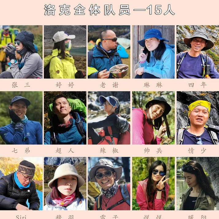
- Total Distance: ~61 km
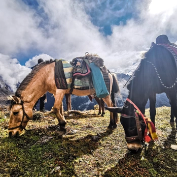
- Trekking Style: Horses carry gear; you hike light
- Camping: Full camping (occasional wooden huts for shelter, extra cost)
- Climate: Highly variable—rain, snow, or hail possible
- Altitude: Cross 3+ passes above 4,500 m; highest >4,700 m
Day-by-Day Breakdown:
| Day | Route | Elevation | Highlights |
|---|---|---|---|
| D1 | Gālù Village → Bái Hé Bridge → Púsà Dòng Waterfall → Mǎn Cuò Pasture Camp | 3,700 m | First camp, waterfall encounter |
| D2 | Mǎn Cuò → Zàng Bié Pasture → Wàn Huā Chí Pasture Camp | 4,200 m | Alpine meadows, wildflowers |
| D3 | Wàn Huā Chí → Zá Bā Lā Pass (4,700 m) → Xīn Guǒ Pasture Camp | 4,300 m | Highest pass crossing |
| D4 | Xīn Guǒ → Hēi Hú Pass → Shé Hú Camp | 4,500 m | Black Lake, Snake Lake |
| D5 | Shé Hú → Sōng Duō Pass → Niú Nǎi Hǎi → Wǔ Sè Hǎi → Yading Scenic Area | — | Milk Lake, Five-Color Lake, exit |
H3: Pre-Trip Preparation – Safety First
Altitude Sickness Management:
- Never enter the mountains with a cold (risk of high-altitude pulmonary edema)
- Light training only—avoid muscle strain
- Prioritize sleep and hydration
Mental Health Warning:
If you have conditions like mania, depression, or severe insomnia, consult a doctor before departure. Altitude plus exhaustion can worsen symptoms; medications may fail at high elevation. Do not take sleeping pills—they can cause respiratory depression.
Emergency Plan:
- Coordinate with your horse handler: if altitude sickness becomes unbearable (severe headache, vomiting, fever), ride a horse down immediately.
- Share your itinerary with a trusted friend. Set a check-in date so rescue can be initiated if you lose contact.
H3: Gear Checklist – Tested on the Trail
I shared a tent, so I carried these essentials:
| Priority | Item | Notes |
|---|---|---|
| 1 | Down jacket + fleece + waterproof shell | Plateau temperature swings are extreme |
| 2 | Sleeping bag (rated -10°C or lower) | Non-negotiable for warmth |
| 3 | Waterproof, high-top hiking boots | Slip-resistant sole |
| 4 | Trekking poles (use two) | Stability on loose scree |
| 5 | Headlamp/flashlight | Essential for night camp |
| 6 | Insulated water bottle (1L+) | Drink 3L hot water daily |
| 7 | Sunscreen, sunglasses, sun hat | UV is brutal at altitude |
| 8 | First-aid kit | Band-aids, disinfectant, pain relievers |
Medications That Worked:
- Panadol (Paracetamol): Best for altitude headaches
- Omer Oxygen-Carrying Tablets: Start 24 hours before entry, 2 tablets morning/evening (more reliable than Rhodiola)
- Japanese Taisho Cold Granules: Quick relief at first cold symptom
- Loperamide (Imodium) + digestive tablets: Plateau water can upset your stomach
Skip: Oxygen cans and Rhodiola rosea—mostly psychological comfort.
H3: Transportation & Budget – Real Costs
Getting There:
- Outbound: Fly/train to Xīchāng
- Return: From Chéngdū (plane, high-speed rail, or train)
Local Travel:
- Xīchāng → Mùlǐ: Bus or private car
- Mùlǐ → Gālù Village: Private car (~8 hours)
Per-Person Cost (National Day Golden Week, excluding long-distance travel): ~2,589 RMB
H2: Journey Chronicle – Five Days and Four Nights of Ultimate Experience
H3: D0 – Final Rest Before the Mountains
On September 28, we arrived in Xīchāng—more bustling than expected. Shopping malls, cinemas, parks. We made last supply runs and watched The Climbers. It felt like an omen.
On September 29, we took a bus to Mùlì, then a private car to Gālù Village. At 1 a.m., we reached guide Piānchū’s home—a traditional Tibetan wooden house, warm and simple. His family served butter tea and roasted barley flour. We tried making tsampa (clumsily), but the genuine interaction felt incredibly welcoming.
On September 30, we rested in Gālù Village. Village children gathered around; their eyes were like stars. Piānchū’s father, who couldn’t speak Chinese, handed us freshly picked green apples. His mother and child knocked walnuts from a tree, then scooped up a pile for us. These small acts of warmth redefined “prejudice” for me.
H3: D1 – Upstream Against the Current, Encountering a Mountain Waterfall
At 6 a.m., alarms rang in unison. We crawled out of sleeping bags, drank Tibetan pork soup simmered overnight by teammate Chāorén, and set off.
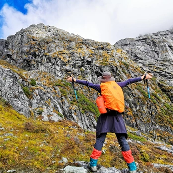
The trail followed a roaring river. We crossed wooden bridges, climbed through pine forests, and soon reached Púsà Dòng Waterfall—a hidden cascade plunging into a turquoise pool. The spray felt like a blessing.
By late afternoon, we arrived at Mǎn Cuò Pasture Camp (3,700 m). The sky was a deep, endless blue. We set up tents, boiled water, and watched the stars emerge one by one.
[Link: Best time to trek Daocheng Yading – seasonal guide]
H3: D2 – Alpine Meadows and Wildflower Pastures
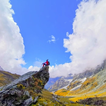
Day two took us through Zàng Bié Pasture and into Wàn Huā Chí Pasture (4,200 m). The landscape opened into rolling green meadows dotted with purple and yellow wildflowers. Yaks grazed in the distance.
The altitude began to bite. Headaches and shortness of breath were common. We reminded each other: slow and steady. Drink water. Rest often.
Camp that night was at Wàn Huā Chí. The sunset painted the peaks in gold and rose.
H3: D3 – Crossing Zá Bā Lā Pass (4,700 m)
The hardest day. We woke at 4:30 a.m. to frost on the tent. The trail climbed relentlessly toward Zá Bā Lā Pass, the highest point of the trek.
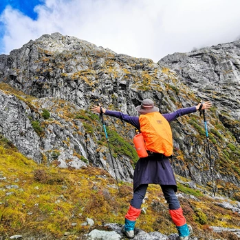
Each step felt heavier. The air was thin. I focused on the rhythm of my poles and the sound of my breath. At the top, the wind howled. We huddled together for a photo—a moment of triumph.
Descending to Xīn Guǒ Pasture Camp (4,300 m) felt like a reward. We ate noodles, drank hot tea, and fell asleep early.
[Link: How to prevent altitude sickness on high-altitude treks]
H3: D4 – Black Lake and Snake Lake
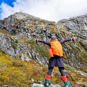
Day four was shorter but no less spectacular. We crossed Hēi Hú Pass, where a dark, mirror-like lake reflected the surrounding peaks. Then we descended to Shé Hú (Snake Lake) Camp (4,500 m).
The lake was serpentine, winding through a valley of scree and moss. We set up camp early and spent the afternoon exploring the shoreline. The silence was profound.
H3: D5 – Milk Lake, Five-Color Lake, and Exit into Yading
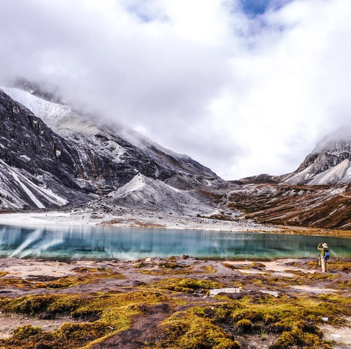
The final day was a blur of beauty. We crossed Sōng Duō Pass, then descended to Niú Nǎi Hǎi (Milk Lake) —a milky turquoise gem cradled by cliffs. A short climb later, Wǔ Sè Hǎi (Five-Color Lake) appeared, shimmering in shades of blue, green, and gold.
From there, we entered the Yading Scenic Area. The crowds and paved paths felt surreal after five days of wilderness. We took a shuttle to the park exit, exhausted but transformed.
H2: FAQ – Trekking the洛克 Line
Q1: Is the洛克 Line suitable for beginners?
No. This is a challenging high-altitude trek requiring good fitness, prior hiking experience, and proper altitude acclimatization. Beginners should start with shorter, lower-altitude treks.
Q2: What is the best time to hike the洛克 Line?
June to October. Summer offers wildflowers and milder weather; autumn (September–October) provides clear skies and vibrant colors. Avoid winter and early spring due to snow and extreme cold.
Q3: Do I need a guide?
Yes, strongly recommended. The trail is unmarked in many sections, and weather can change rapidly. Local guides also handle horse logistics and emergency support.
Q4: Can I do the trek without camping gear?
No. You must bring your own sleeping bag, tent (or share), and cooking gear. Horses carry supplies, but you need to be self-sufficient.
Q5: What happens if I get severe altitude sickness?
Your guide and horse handler will arrange an immediate descent by horse. Always carry emergency contact details and a backup plan.
H2: Conclusion – Your Journey Awaits
The洛克 Line is not a vacation. It is a test of will, a lesson in humility, and a gift of raw, untamed beauty. From the kindness of Muli villagers to the sacred silence of Snake Lake, every moment etches itself into memory.
If you are ready to step beyond comfort, to trade Wi-Fi for starry skies and paved roads for rocky passes, then this trek is for you.
Start planning today.
[Link: Book a guided洛克 Line trek]
[Link: Download our complete Daocheng Yading packing checklist]
The mountains are calling. Will you answer?