2025 Autumn Return to Western Sichuan: The Genie South Route — A Six-Day, Five-Night Ultimate Journey of "Eyes in Heaven, Body in Hell"
Meta Description: Discover the ultimate Western Sichuan autumn road trip: the Genie South Route. 6 days, 5 nights of breathtaking scenery, altitude challenges, and practical tips for an unforgettable 2025 adventure.
Introduction: An Unexpected Autumn Break, a Long-Planned Reunion with Western Sichuan
In September 2025, the Foshan Education Bureau turned a November autumn break into reality. For my wife and me — a couple perpetually "trapped" by our two children — this was a gift from heaven: a chance to briefly escape daily parenting, avoid peak tourist crowds, and reunite deeply with Western Sichuan's autumn colors during the most beautiful season.
A few years ago, we rushed through a small loop of Western Sichuan. That superficial road trip left me unsatisfied. The snow-capped mountains, colorful forests, and alpine meadows of the plateau kept glowing in my memory. This autumn break finally gave us a chance to "make up for it."
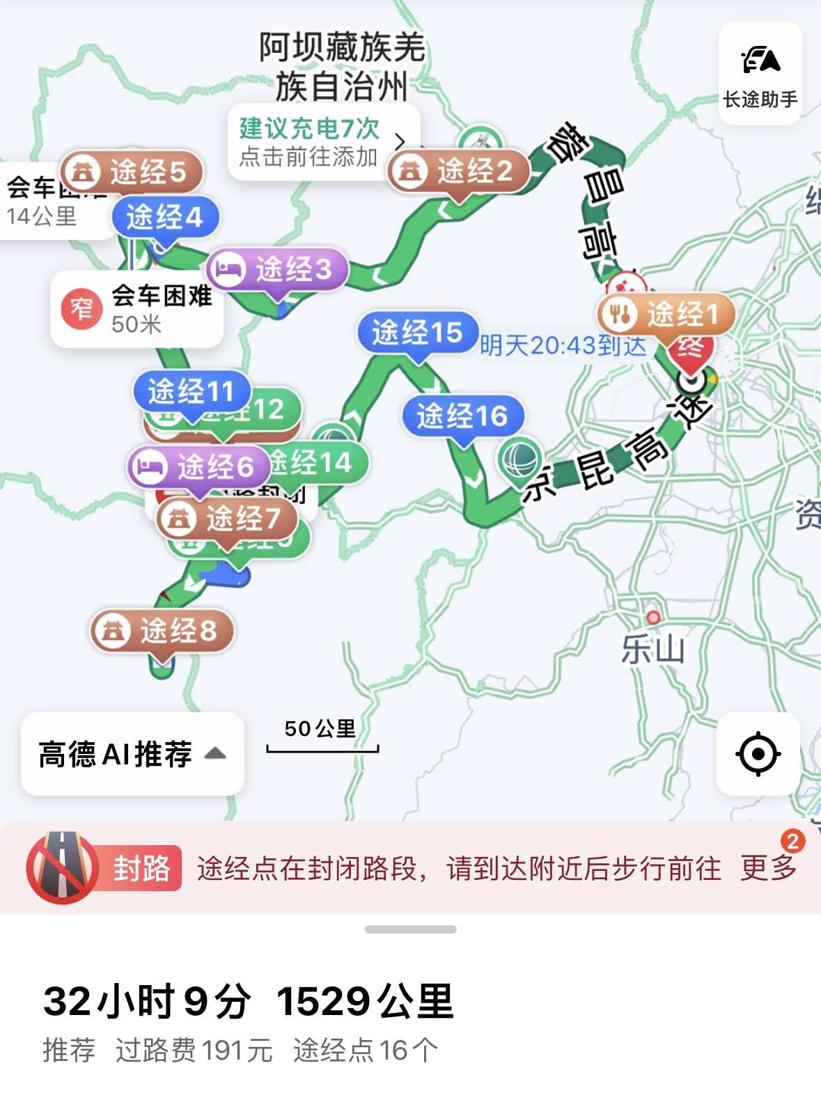
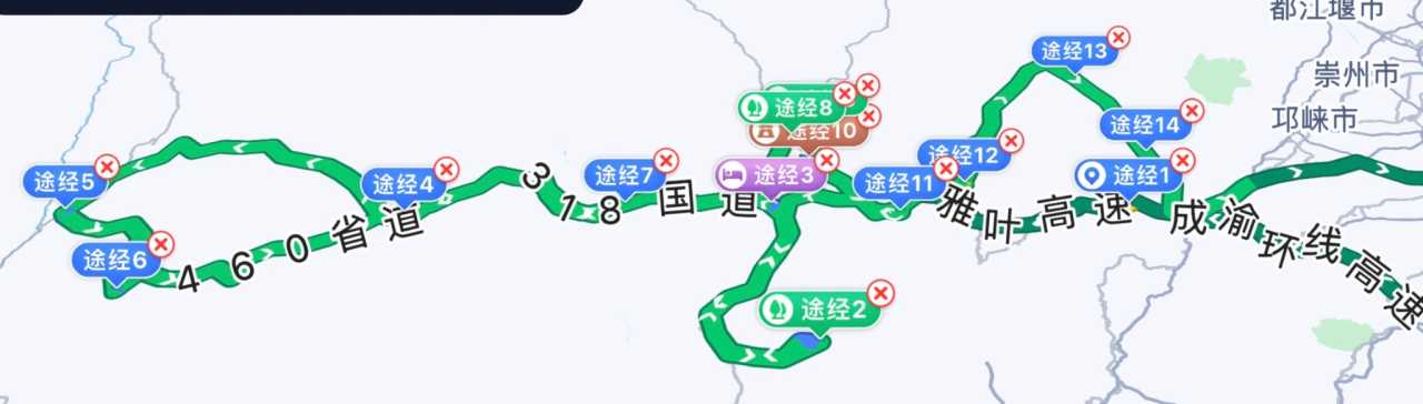
Our initial plan was a loop consisting of the Li-Xiao Road, the Dandao Secret Realm, and the Baokang Route. Starting from Chengdu, we would take the Li-Xiao Road to Danba, then visit Jiayi Lak Co, Yuke Prairie, Genba Ridge, Zimei Pass, Xindu Bridge, and Yala Sacred Mountain, before returning to Chengdu via Kangding and the Baokang Route. This route avoids backtracking and covers the essence of Western Sichuan autumn scenery. But as other regions announced their autumn breaks, we began to worry that this loop — so close to Chengdu — would become crowded. After weighing our options, we chose a more remote destination that has surged in popularity: the Genie South Route as our core destination.
As it turned out, this decision let us experience what it truly means to have "eyes in heaven, body in hell" — 2,100 kilometers in total, over seven hours of driving each day, with my wife gritting her teeth through repeated bouts of altitude sickness and oxygen inhalations. Yet every single frame along the way became an unforgettable treasure in our lives.
Pre-Departure Preparations: Car Rental, Gear, and Mindset for the Genie South Route
Car Rental for Western Sichuan: The Unexpected Delight of a Model Y
We rented a 2025 Model Y from the Shuangliu Airport branch of "EHi Car Rental." The five-day rental cost less than 1,400 RMB. Including charging expenses, the total was actually cheaper than driving our own gas-powered car. Even more surprising was that the density of charging stations along the Western Sichuan route far exceeded our expectations — zero range anxiety. The Autopilot function on the highway was a huge energy-saver: on a plateau where you're driving for seven hours straight, having one less thing to worry about means one more layer of safety.
EHi's rental process was also commendable: pick up the car, sign your name, and drive off. When we returned the vehicle, it was caked in dust, but the staff didn't even bother to inspect it — just drop the keys and leave. That kind of trust makes you look forward to renting from them again.
Essential Gear for High-Altitude Travel: Oxygen Is the Real Currency
Western Sichuan's altitude generally exceeds 3,000 meters, especially in Litang, where the average altitude is over 4,000 meters. Since we didn't bring the kids this time, our biggest worry was gone, but altitude sickness was still an unavoidable hurdle. We prepared in advance: portable oxygen canisters, Rhodiola rosea (a traditional altitude remedy), ibuprofen, a thermos, sunscreen, sunglasses, and a windbreaker. As it turned out, oxygen canisters were the real "hard currency" — along the route from Kangding to Batang, the price for refilling oxygen dropped from 18 RMB to 7 RMB. At every town, our first task was to find the hospital to refill oxygen.
[Link: Altitude Sickness Prevention Tips for Western Sichuan]
Day 1: Foshan → Chengdu — Night Market and Sleeping in the Service Area
At 3:00 PM on November 11th, we drove from Foshan's Sanshui District to an airport hotel near Guangzhou Baiyun Airport (free parking), then took a taxi to the airport. Our 6:30 PM flight arrived at Chengdu Shuangliu at 9:00 PM. Picking up the car, loading our luggage, and setting the navigation — all in one smooth motion.
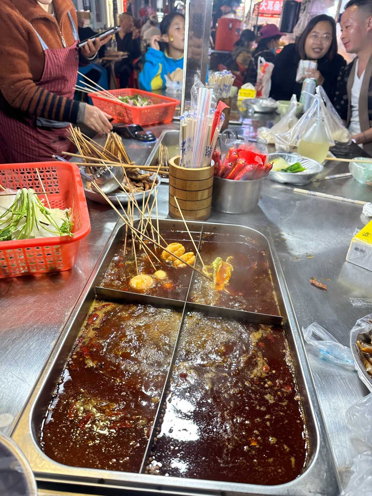
Our first stop was the Liuwan Night Market — near the university district and reputed to be one of Chengdu's liveliest night markets. Perhaps because it was late (10:00 PM) and not peak season, the market wasn't crowded. We ate some chuan chuan (skewers), strolled around, and soaked in Chengdu's vibrant street atmosphere.
At 11:00 PM, we drove to the Tianquan Service Area. This is a famous pit stop along National Highway 318, with excellent facilities. But by the time we arrived — past 1:00 AM — all the shops were closed. We found a corner in the empty parking lot and slept in the car. The Model Y's rear space was spacious enough; folding down the seats created a makeshift bed. It wasn't as comfortable as a hotel, but it saved us time and accommodation costs, and it recharged our energy for the long drive ahead the next day.
Day 2: Chengdu → Xindu Bridge — Regret and Surprise at Zimei Pass

Erlang Mountain and Zheduo Mountain in Morning Light
The next morning, the mountains around the service area were shrouded in mist, like a fairyland. We quickly washed up, ate breakfast, and headed toward Kangding. As we passed through the Erlang Mountain Tunnel again, I made sure to photograph the Party flag inside — I hadn't had a chance on our last trip, and this time I finally got my wish.
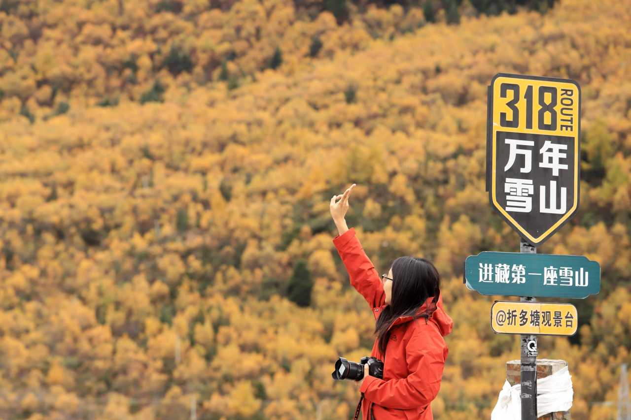
On the other side of the tunnel, the weather was completely different: sunlight pierced through the clouds, and colorful forests gradually came into view. We passed by Zheduo Pond and Zheduo Mountain — on our previous Western Sichuan trip, we had taken Provincial Road 434, so this was the first time we crossed Zheduo Mountain, the "first mountain into Tibet." Our first stop was the Ganzi Tibetan Autonomous Prefecture People's Hospital in Kangding to refill oxygen, preparing for the altitude sickness ahead.
Zimei Pass: Twenty Kilometers of Potholes, Rewarded with Fog
Today's core destination was Zimei Pass and a few popular villages around Genba Ridge. The plan was to first visit Tiwu Village and Nati Village, then head up to Zimei Pass, and finally return to Xindu Bridge for the night. But time was tight, so we skipped Nati Village and drove straight to Zimei Pass.
From the fire checkpoint at Sewurong Village, the nightmare began. The road from Gongga Mountain Town to Zimei Pass — over twenty kilometers — was almost entirely potholed mountain track, with the car bouncing incessantly. My wife, suffering from altitude sickness and the shaking, vomited again and again. In comparison, the potholed roads on the later Genie South Route seemed like a walk in the park.
The biggest disappointment came when we reached the summit: thick fog blanketed everything, completely hiding Gongga Snow Mountain. We could only launch the drone — and from its perspective, the view was indeed breathtaking; we even captured a Buddha's halo (a rare optical phenomenon). But on the second launch, the drone crashed. Fortunately, it wasn't destroyed. We waited at the summit for over an hour, but the fog never lifted. We later learned that just a few days before our visit and a few days after we left, visitors could see stunning golden-hour sunlight on the peaks and seas of clouds. That's travel — full of regret and surprise.
By the time we descended, it was already dark. Over twenty kilometers of potholed road plus several hours of driving — no signal, no scenery — it felt like it would never end. At 10:00 PM, we finally reached our hotel in Xindu Bridge. Exhausted in body and mind, cold and hungry, we organized our things, video-called the kids, and immediately went looking for food. The hotel front desk recommended a place called "Shangpin Oxtail Soup Hotpot" (尚品牛尾汤锅火锅), and it saved us — maybe because we were so hungry, but we both agreed it was the best meal of the entire trip.
The hotel had an oxygen supply system, which helped us sleep better despite the high altitude.
[Link: Best Hotels in Xindu Bridge for Autumn Travel]
Day 3: Xindu Bridge → Litang — The Heart of the Genie South Route
Morning at Xindu Bridge: A Glimpse of Autumn Perfection
We woke early, hoping for clear skies at Xindu Bridge — a world-famous photography spot. The morning light painted the mountains gold, and the autumn foliage was at its peak. We spent a couple of hours capturing the scenery before heading toward Litang, the gateway to the Genie South Route.
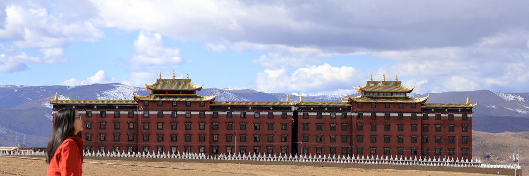
The drive from Xindu Bridge to Litang took us through some of the most dramatic landscapes in Western Sichuan. The road climbed steadily, passing through Kazila Mountain (4,700 meters) and Tailing Temple, a beautiful Tibetan Buddhist monastery perched on a hillside. We stopped for photos and to stretch our legs, but the altitude was already taking its toll on my wife.
Entering the Genie South Route: Remote Beauty, Rough Roads
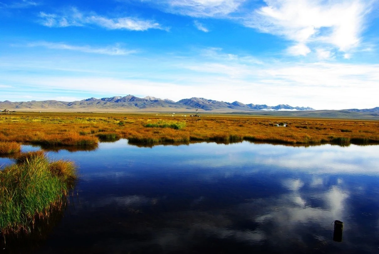
By afternoon, we reached the turnoff for the Genie South Route. This is not a well-paved road — it's a rugged, unpaved track that winds through remote valleys and high passes. The scenery was otherworldly: golden grasslands, jagged peaks, and crystal-clear streams. But the driving was punishing. The car bounced over rocks and ruts, and my wife was struggling with worsening altitude sickness.
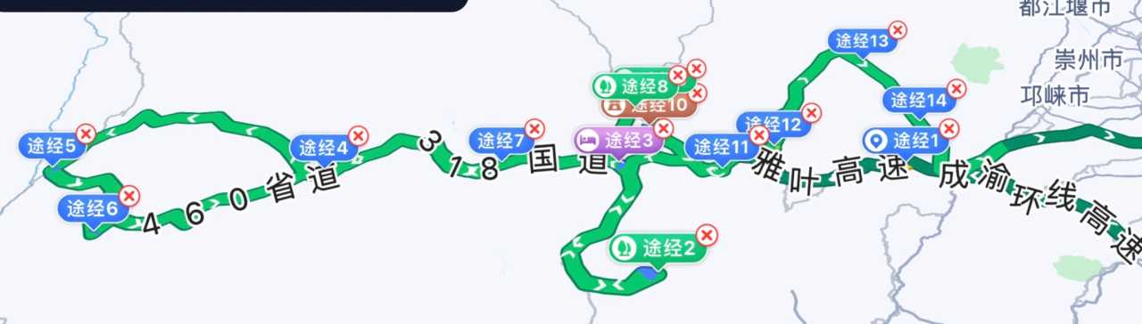
We pushed on, stopping occasionally for oxygen refills and to admire the views. The Genie South Route is famous for its isolation — there are no towns, no gas stations, and very few other travelers. It's just you, the landscape, and the sky.
By evening, we arrived in Litang, the highest city in the world at over 4,000 meters. We checked into a hotel with oxygen supply and spent the night recovering. My wife was exhausted but determined to continue.
[Link: Genie South Route Driving Guide: What to Expect]
Day 4: Litang → Batang — The Ultimate Test of Endurance
Morning in Litang: A City on the Roof of the World
Litang is a fascinating place — a Tibetan city with a vibrant culture and stunning surroundings. We visited the Litang Temple and walked through the old town, but the altitude made every step a challenge. My wife was using oxygen regularly, and I was feeling the effects too — headaches, shortness of breath, and a general sense of fatigue.
Despite this, we set out for Batang, a town at a lower altitude (about 2,500 meters) that would offer some relief. The drive took us through the Genie South Route's most dramatic section: the Genie Pass at 4,800 meters, where the views were absolutely breathtaking. Snow-capped mountains stretched to the horizon, and the autumn colors were at their peak.
The Descent to Batang: Relief and Reward
The road from Genie Pass to Batang was a steep descent, dropping nearly 2,000 meters in altitude. My wife's symptoms began to ease as we descended, and by the time we reached Batang, she was feeling much better. We checked into a comfortable hotel, had a hot meal, and finally got a good night's sleep.
Batang is a charming town with a mix of Tibetan and Chinese cultures. We spent the evening exploring the streets and enjoying the lower altitude.
[Link: Altitude Sickness Remedies: What Worked for Us]
Day 5: Batang → Kangding — The Long Drive Home
Morning in Batang: A Peaceful Start
We woke up feeling refreshed, grateful for the lower altitude. Batang's morning market was bustling with locals selling fresh produce, Tibetan jewelry, and traditional crafts. We bought some snacks for the road and set off for Kangding, the capital of Ganzi Prefecture.
The drive back was long but scenic. We retraced part of the Genie South Route, then joined the main highway heading east. The autumn colors were still stunning, but the fatigue of the trip was starting to catch up with us.
Kangding: A Cultural Hub
We arrived in Kangding in the late afternoon. This city is a major stop on the Sichuan-Tibet Highway (National Highway 318) and has a rich history as a trading post. We visited the Kangding Love Song Scenic Area and walked along the river, enjoying the cool mountain air.
That night, we treated ourselves to a hotpot dinner — a fitting end to a challenging journey.
[Link: Top Things to Do in Kangding]
Day 6: Kangding → Chengdu → Foshan — Homeward Bound
The Final Drive: Kangding to Chengdu
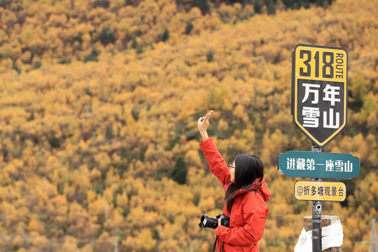
We left Kangding early, knowing we had a long drive ahead. The road from Kangding to Chengdu is well-paved but winding, passing through the Erlang Mountain Tunnel and the Luding Bridge — a historic site from the Long March.
By early afternoon, we reached Chengdu. We returned the rental car to the Shuangliu Airport branch, had a quick lunch, and caught our flight back to Guangzhou. From there, we drove home to Foshan, arriving late that night.
Reflections on the Genie South Route
As we sat in our living room, exhausted but happy, we looked through the photos and videos from the trip. The Genie South Route had delivered on its promise: "eyes in heaven, body in hell." The scenery was beyond anything we could have imagined, but the physical toll was immense. For my wife, it was a test of endurance she didn't know she had. For me, it was a reminder of why we travel — to push ourselves, to see beauty, and to create memories that last a lifetime.
Frequently Asked Questions (FAQ) About the Genie South Route
1. What is the best time to visit the Genie South Route?
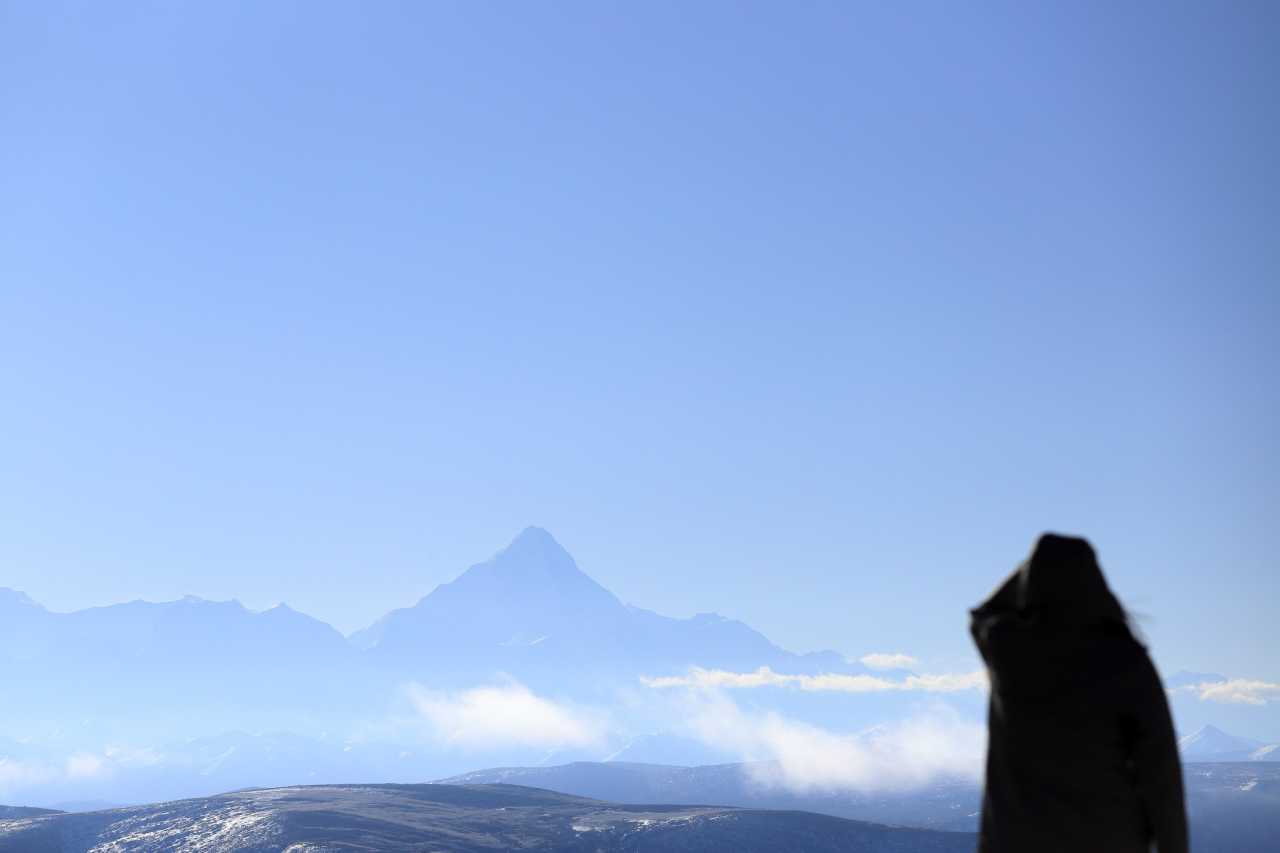 The best time is autumn (September to November) when the autumn colors are at their peak and the weather is generally stable. Avoid the rainy season (June to August) and winter (December to February) when roads can be icy or closed.
2. How difficult is the Genie South Route for driving?
Very difficult. The route is mostly unpaved, with rough roads, steep climbs, and narrow passes. A 4WD vehicle is recommended, though a high-clearance SUV can manage. Be prepared for long stretches without services.
3. What altitude should I expect on the Genie South Route?
The route ranges from 2,500 meters (Batang) to over 4,800 meters (Genie Pass). Most of the route is above 4,000 meters. Altitude sickness is a real risk, so prepare with oxygen, medication, and acclimatization.
4. Can I do the Genie South Route in a rental car?
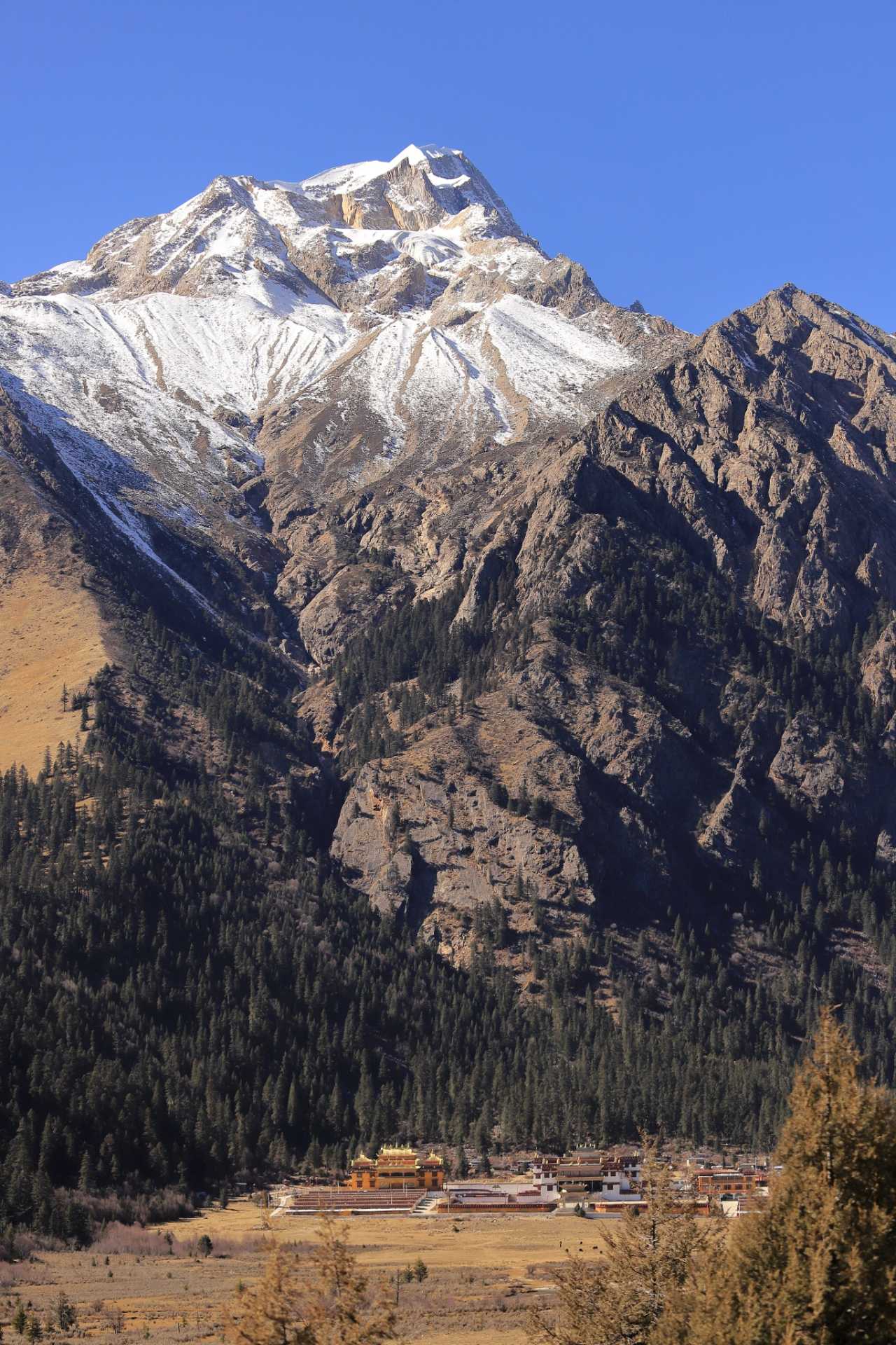 Yes, but choose a vehicle with high ground clearance and good suspension. We used a Model Y, which handled the roads surprisingly well, but a gas-powered SUV might be more reliable for remote areas.
5. What should I pack for the Genie South Route?
Essential items include: portable oxygen canisters, altitude sickness medication, warm clothing (temperatures can drop below freezing), a first-aid kit, plenty of water and snacks, a satellite phone or offline maps, and a drone for aerial photography.
Call to Action: Plan Your Own Western Sichuan Autumn Adventure
The Genie South Route is not for everyone — it's a test of endurance, a challenge of body and mind. But for those who are willing to endure the "hell," the "heaven" is unforgettable. If you're planning a trip to Western Sichuan in 2025, consider adding the Genie South Route to your itinerary.
Ready to start planning? Book your rental car early, prepare your gear, and don't forget to check the weather forecast. For more tips on Western Sichuan travel, check out our guides on [Western Sichuan Road Trips] and [High-Altitude Travel Tips].
Share your own experience! Have you driven the Genie South Route? What was your favorite moment? Let us know in the comments below.
Note: This article is based on a personal travel experience from November 2025. Route conditions, prices, and availability may vary. Always check current conditions before traveling.
You may also like