Daocheng Yading Travel Guide 2025: Hiking Routes, Altitude Tips & Essential Itinerary
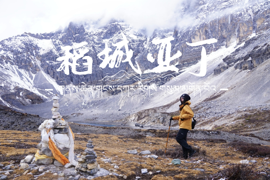
Meta Description: Planning a trip to Daocheng Yading? This complete 2025 guide covers hiking routes (short & long), altitude sickness prevention, accommodation options, transportation tips, and essential FAQs for the "Pure Land of the Blue Planet."
Introduction: Why Daocheng Yading Belongs on Every Traveler's Bucket List
There are places that linger in your imagination long before you ever set foot there. For countless travelers, Daocheng Yading is exactly that—a name whispered among adventure seekers, a dream destination that feels almost mythical. Known as the "Pure Land of the Blue Planet," this high-altitude paradise in Sichuan's Garzê Tibetan Autonomous Prefecture offers some of China's most breathtaking alpine scenery.
But here's the truth: Daocheng Yading is not a casual day trip. With elevations ranging from 3,800 to 4,700 meters, this is one of the most physically demanding scenic areas in China. The thin air, unpredictable weather, and challenging trails demand respect. In May 2025, just weeks after completing both hiking routes, I learned of a tragic incident where a tourist went into shock on the long-route challenge section and passed away.
This guide will help you prepare properly—so you can experience the magic safely and return home with memories, not regrets.
How to Get to Daocheng Yading: Flight vs. Road Travel
✈️ Flying to Daocheng Yading Airport: Fast but Risky

Daocheng Yading Airport sits at over 4,400 meters above sea level—one of the highest civilian airports in the world. While flights from Chengdu take just over an hour, the rapid altitude change can trigger severe altitude sickness in unprepared travelers.
Key details: - Distance from airport to scenic area: ~130 km - Airport bus to Daocheng County: 35 RMB/person - Airport bus to Shangri-La Town: 85 RMB/person - Return shared ride from Shangri-La Town: ~100 RMB/person (arrange through your guesthouse)
Warning: If you have no high-altitude experience, consider road travel instead. Flying directly into 4,400m can be dangerous.
🚗 Road Travel: Gradual Acclimation, Richer Experience
Taking a bus from Chengdu into western Sichuan is the most common approach. This allows your body to gradually adapt to increasing elevations.
Direct bus from Chengdu: - Departure: Xinnanmen Bus Station, 6:20 AM daily - Duration: ~15-16 hours - Cost: 298 RMB/person - Return bus: 6:00 AM from Yading Tourist Bus Station, 302 RMB/person
Self-driving or hiring a car offers more flexibility. You can customize your itinerary, keep daily driving distances shorter, and stop at attractions along the way.
💡 My Recommendation
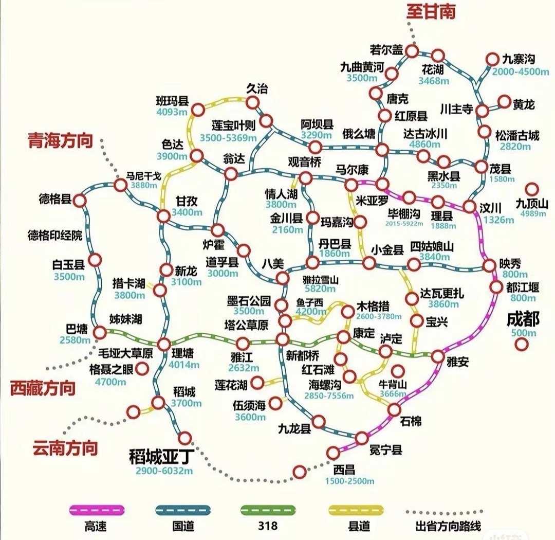
Since my aunt was experiencing the plateau for the first time, I chose the bus for the gradual altitude adjustment. For the return trip (tight schedule around May Day), I flew. This route also allowed me to visit Mount Siguniang and Moshí Park (Stone Ink Park)—attractions I'd missed on previous trips.
[Link: Best Sichuan road trip itineraries for first-time visitors]
Where to Stay Near Daocheng Yading: Three Options Compared
| Location | Altitude | Pros | Cons |
|---|---|---|---|
| Daocheng County | 3,750m | Best amenities, lower prices, close to airport | 80km from scenic area (1.5hr drive) |
| Shangri-La Town | 2,900m | Great value, good acclimatization, well-stocked | Moderate distance to scenic area |
| Yading Village | ~3,900m | Sunrise views, early access to trails | Severe altitude risk, expensive, limited dining |
🏘️ Daocheng County: Most Amenities, Farthest from Trails
If you stay here, you'll need to wake up very early to reach the scenic area. The altitude (3,750m) isn't low, so sleep quality may suffer. Best for travelers who prioritize comfort over convenience.
🏡 Shangri-La Town: The Smart Middle Ground
At just 2,900 meters, this is the best option for altitude acclimatization. The town is well-stocked with restaurants, supermarkets, a hospital, and even a hair salon (washing your hair costs ~45 RMB—convenient and safer than doing it yourself at high altitude).
Two accommodation zones: - Town Center: Walking distance to restaurants, 15-20 minutes by car to visitor center - Hillside near visitor center: Less than 5 minutes to scenic area, but limited dining
Transportation: 10 RMB/person to scenic area, 100 RMB/person private car to airport (~2 hours)
🏔️ Yading Village: For Sunrise Chasers Only
Staying here means you can watch golden sunrise over snow-capped peaks and reach scenic spots before crowds. However, the altitude (~3,900m) causes severe altitude sickness for many. Temperatures near freezing in May, and you'll be essentially stuck at your hotel.
Important: If staying here, your ticket allows three-day entry. Tell the ticket seller when purchasing, and tell the shuttle bus driver you're getting off at Yading Village.
[Link: Best guesthouses in Shangri-La Town for Daocheng Yading]
Daocheng Yading Hiking Routes: Complete Trail Guide
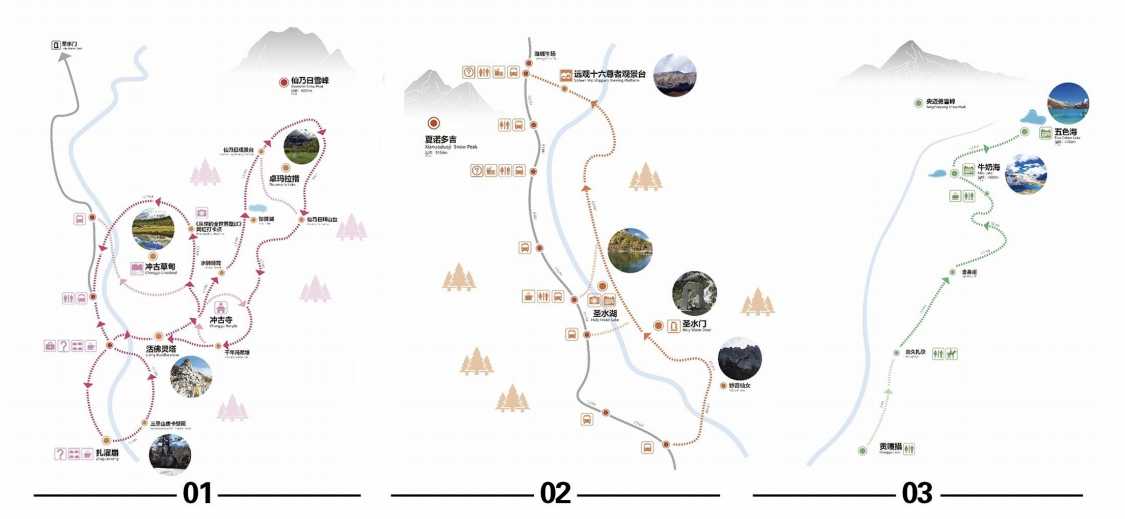
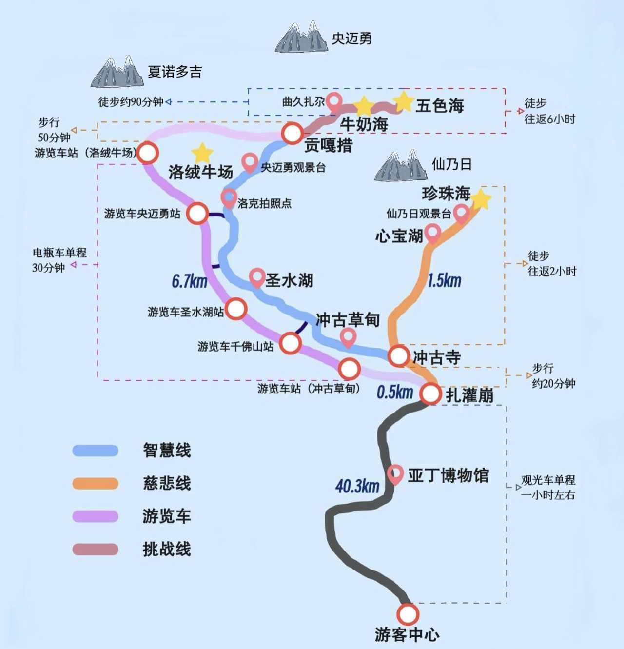
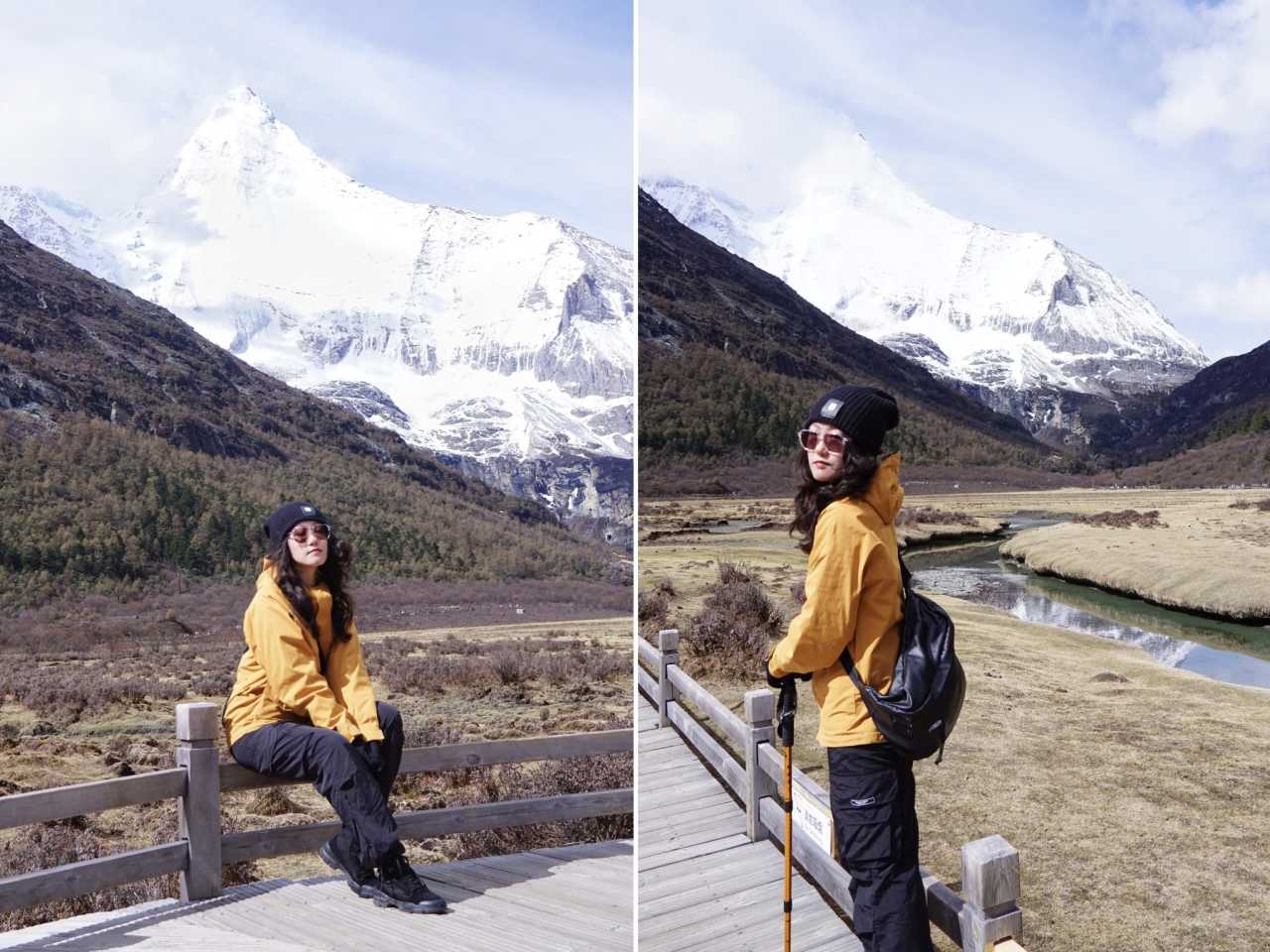
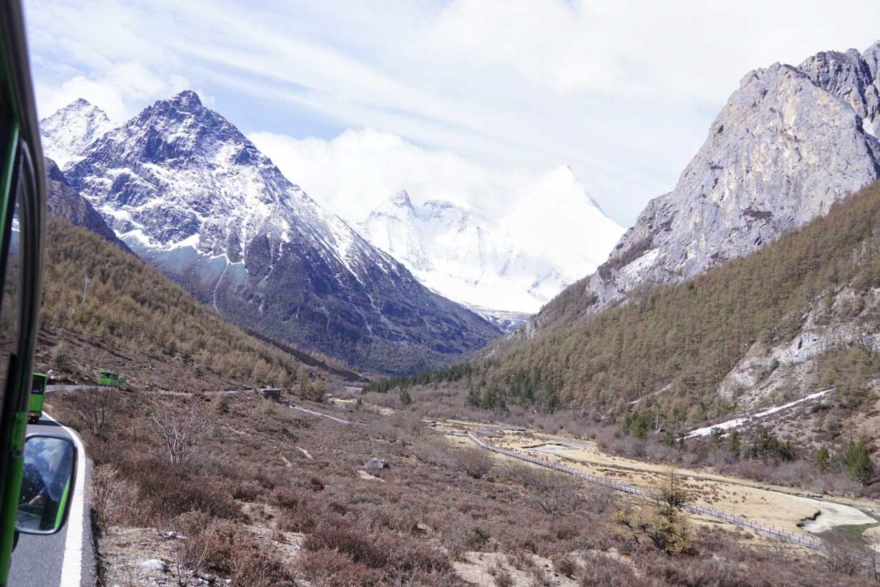
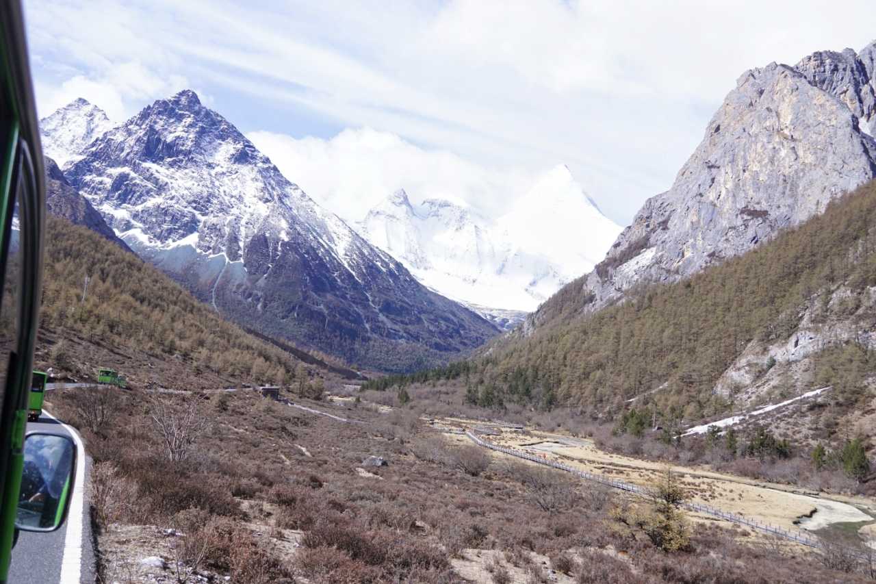
The scenic area centers around three sacred mountains—Xiannairi (Chenresig, 5,998m), Yangmaiyong (Chana Dorje, 5,958m), and Xianuoduoji (Jambeyang, 5,951m)—surrounded by glacial lakes, forests, canyons, and meadows. The area is shaped like a "Y," starting from the visitor center via shuttle bus to Zhaguanbeng.
Route 1: Guanyin's Compassion Route (Short Route)
Theme: Visit the northern peak, Mount Xiannairi
Route: Zhaguanbeng → Living Buddha's Stupa → Chonggu Monastery → Zhuomala Lake (Pearl Lake) → Chonggu Meadow
Distance: ~4.5 km total (2 km of slopes)
Duration: 3-5 hours
Best for: Travelers with limited time or average fitness
Route 2: Manjushri's Wisdom Route (First Half of Long Route)
Theme: Distant views of Mount Xianuoduoji and Mount Yangmaiyong
Route: Zhaguanbeng → Celestial Maiden → Holy Water Gate → Holy Water Lake → Sixteen Arhats → Luorong Pasture
Transportation: Electric cart available (40 RMB/person one way, 70 RMB/person round trip)
Optional extension: Continue to Gongga Lake (horse riding available, 300 RMB/person one way, only 120 tickets daily—arrive early)
Distance: ~12 km one way
Route 3: Vajra Challenge Route (Second Half of Long Route)
Theme: Close-up views of Mount Yangmaiyong
Route: Gongga Lake → Milk Lake → Five-Color Lake
Distance: ~3.7 km one way (including 2 km of climbing, elevation from 4,300 to 4,700 meters)
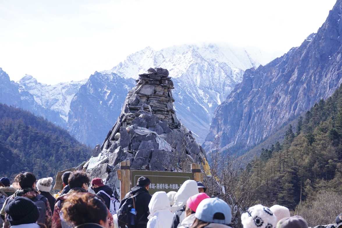
Duration: 5-6 hours round trip
Seasonal closure: November through April
Warning: This is the most dangerous section. The 0.1% who push beyond their limits risk their lives. Know your limits.
[Link: How to prevent altitude sickness on high-altitude hikes]
Essential Tips for Hiking Daocheng Yading
Altitude Sickness Prevention
 - Acclimate gradually: Spend at least one night at 2,900m (Shangri-La Town) before attempting trails - Hydrate constantly: Drink 3-4 liters of water daily - Avoid alcohol and heavy meals for the first 48 hours - Carry oxygen canisters (available in town for ~30-50 RMB) - Know the symptoms: Headache, nausea, dizziness, shortness of breath—if severe, descend immediately
What to Pack
- Layered clothing (temperatures range from near-freezing at dawn to 15°C midday)
- Waterproof jacket and pants
- Sturdy hiking boots with good ankle support
- Sunscreen (UV is intense at altitude)
- Sunglasses and wide-brimmed hat
- Snacks (energy bars, nuts, chocolate)
- At least 2 liters of water
- Basic first-aid kit including altitude sickness medication
Timing Your Visit
- Best season: May to October (long route closed November-April)
- Best time of day: Start by 7:00 AM to avoid afternoon weather changes
- Peak crowds: October (golden autumn colors) and May Day/National Day holidays
Daocheng Yading FAQ
1. How difficult is the long route hike?
The long route (including Milk Lake and Five-Color Lake) is physically demanding. The 3.7 km climb from Gongga Lake to Five-Color Lake involves 400 meters of elevation gain at altitudes above 4,300 meters. Most people with average fitness can complete it, but altitude sickness can affect anyone regardless of fitness level.
2. Can I do both routes in one day?
Technically yes, but not recommended. The short route takes 3-5 hours, and the long route takes 5-6 hours. Combined with travel time and altitude challenges, most visitors split them across two days.
3. What's the best accommodation for altitude acclimatization?
Shangri-La Town (2,900m) is ideal. It's low enough to avoid severe altitude issues but close enough to the scenic area (15-20 minutes by car). Stay here for at least one night before attempting the trails.
4. Is horse riding available on the long route?
Yes, from Luorong Pasture to Gongga Lake (300 RMB/person one way). However, only 120 tickets are available daily, so you need to arrive very early to secure one. Horses cannot go beyond Gongga Lake to Milk Lake or Five-Color Lake.
5. What happens if I get altitude sickness on the trail?
Descend immediately. The scenic area has first-aid stations, but severe cases require evacuation. The tragic incident in May 2025 involved a tourist who continued despite symptoms. Carry emergency contact numbers and know the location of the nearest medical facility (clinic in Yading Village, hospital in Shangri-La Town).
Your Daocheng Yading Action Plan
Daocheng Yading is not just a destination—it's a test of preparation, respect for nature, and understanding your own limits. The rewards are extraordinary: pristine glacial lakes reflecting sacred peaks, ancient monasteries nestled in alpine meadows, and the profound satisfaction of completing one of China's most challenging hikes.
Before you go: 1. ✅ Book accommodation in Shangri-La Town for acclimatization 2. ✅ Arrange transportation (bus for gradual altitude adjustment) 3. ✅ Pack appropriate gear and altitude sickness medication 4. ✅ Study the trail maps and know your limits 5. ✅ Check weather forecasts and trail conditions
Your journey starts now. Whether you're the seasoned high-altitude hiker or the first-time plateau traveler, Daocheng Yading will change how you see the world—and yourself.
Ready to plan your trip? [Link: Book guided tours to Daocheng Yading] or [Link: Download complete packing checklist for high-altitude hiking]
Leave home happy, return home safe—that's the ultimate meaning of travel.
You may also like